Emilia, Italy
Data Map
ShakeMap is a product of the USGS Earthquake Hazards Program in conjunction with the regional seismic networks. ShakeMaps provide near-real-time maps of ground motion and shaking intensity following significant earthquakes. These maps are used by federal, state, and local organizations, both public and private, for post-earthquake response and recovery, public and scientific information, as well as for preparedness exercises and disaster planning. (USGS)
Reconnaissance Photo Gallery
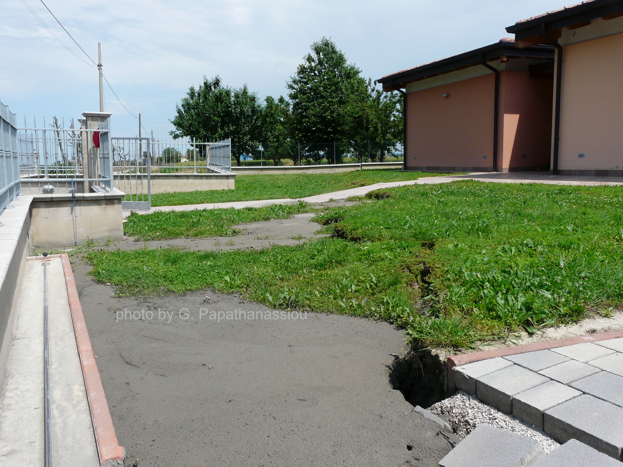
The Reconnaissance Photo Gallery is a repository of photos taken by EERI field teams and other contributors. Many photos are geolocated and allow field teams, researchers, and those involved in recovery effort to identify specific damage locations by site and proximity to other features using the Data Map. The Photo Gallery can be filtered by user and searched for specific records, or used to upload photos in the the field.
Featured Resources
Resources
| Date | Category | Title | Description | |
|---|---|---|---|---|
| 02-04-2018 | DataReport | The 29th May 2012 Emilia Romagna Earthquake EPICentre Field Observation Report | By Dr. Ioanna Ioannou, Randolph Borg, Viviana Novelli, Jose’ Melo, Professor David Alexander, Indranil Kongar, Enrica Verrucci, Bryan Cahill, and Dr. Tiziana Rossetto. June 2012, UCL EPICentre Department of Civil, Environmental and Geomatic Engineering. | |
| 02-04-2018 | Geotechnical Structures (Dams and levees, etc.)Report | Geotechnical Aspects of the 20th May, 2012 M5.9 Emilia Earthquake, Italy | By Carlo G. Lai, Francesca Bozzoni, Maria-Daphne Mangriotis, Mario Martinelli, Laura Scandella, and Filippo Dacarro. July 2012, EUCENTRE | |
| 02-03-2018 | ReportSeismologyStructural Engineering | Preliminary Report on the 2012, May 20th, Emilia Earthquake | By Luis D. Decanini, Domenico Liberatore, Laura Liberatore, and Luigi Sorrentino May 2012, Sapienza University of Rome, Department of Structural Engineering and Geotechnics | |
| 09-13-2018 | ReportSeismology | Preliminary study of Emilia (May 20th 2012) earthquake ground motion records V1.0 | By Eugenio Chioccarelli, Flavia De Luca, and Iunio Iervolino. June 2012, Università degli Studi di Napoli Federico II, Structural Engineer Department. | |
| 09-13-2018 | ReportSeismology | A report on the 2012 seismic sequence in Emilia (Northern Italy) | By Diego C. F. Lo Presti, Mauro Sassu, Lucia Luzi, Francesca Pacor, Doriano Castaldini, Giovanni Tosatti, Claudia Meisina, Davide Zizioli, Francesco Zucca, Giuliano Rossi, Gilberto Saccorotti, and Davide Piccinini. | |
| 09-07-2018 | ReportSeismologyStructural Engineering | The 20th May 2012 Emilia Romagna Earthquake EPICentre Field Observation Report | By Dr. Tiziana Rossetto, Professor David Alexander, Enrica Verrucci, Dr. Ioanna Ioannou, Randolph Borg, Jose’ Melo, Bryan Cahill, and Indranil Kongar. June 2012, UCL EPICentre Department of Civil, Environmental and Geomatic Engineering. | |
| 02-06-2018 | DataLink to external resourceSeismology | Shakemap Emilia-Romagna-Modena Earthquake May 29th 2012 | Figure 1 shows the shakemap computed by INGV using data of the Rete Accelerometrica Nazionale e Rete Accelerometrica Italia Settentrionale, for the peak ground acceleration (PGA) in %g. | |
| 02-06-2018 | DataLink to external resourceSeismology | Some notes about seismotectonics | The May 20th event was generated along a seismogenic structure covered by the sediments of the Po plain; the focal mechanism is clearly reversal as shown in Figure 1. | |
| 02-06-2018 | DataSeismology | Short update on the earthquake sequence | The earthquake of the 29th of May (Ml 5.8) triggered a sequence of earthquakes in the same region. The sequence is summarized in Table 1 and represented in Figure 1. To note the stability of the focal mechanisms during the sequence. | |
| 02-06-2018 | Link to external resourceSeismologyStructural Engineering | Seismic Response of Public Buildings and Infrastructural Systems | The OSS – Seismic Observatory of Structures is the Italian network created and administrated by the Italian Civil Protection to permanently monitor the seismic response of approximately 150 structures including schools, hospitals, town halls and other public buildings, bridges and one... |
Photo Gallery
Photos in this gallery have been contributed by EERI members and California Earthquake Clearinghouse participants. Photos from this gallery can be used for non-commercial purposes with proper attribution.


| Attachment ID | |
|---|---|
| Caption/Description | |
| Latitude | |
| Longitude | |
| Date Taken | |
| Data Copyright Holder | |
| Photographer | |
| Original Filename | |
| Filename | |
| File Type |
| Record ID | |
|---|---|
| Observer Name | |
| Observer Email | |
| Experience Level of Observer | |
| Observation Category | |
| Description | |
| Building Address | |
| Building Occupancy | |
| Building Type | |
| Structural Damage Level | |
| Overall Damage Level | |
| Foundation Damage Level | |
| Damaged Nonstructural Elements | |
| Date and Time of Observation | |
| Type of Bridge | |
| Lifeline Type | |
| Landslide Type | |
| Type of Operation | |
| Liquefaction Features | |
| Surface Rupture Type | |
| Severity of Tsunami/Seiche | |
| Site Type | |
| Building Name | |
| Building Owner | |
| Decade Built | |
| Foundation | |
| Number of Stories Above Ground | |
| Number of Stories Below Ground | |
| Total Building Floor Area | |
| Retrofitted | |
| Year of Retrofit | |
| Vertical Load System | |
| Lateral Load System | |
| Energy Dissipation Devices | |
| Observation Type | |
| Cause of Structural Damage | |
| Damaged Structural Elements | |
| Nonstructural Damaged Level | |
| Safety Assessment Placard | |
| Site Observation | |
| Estimated Economical Loss (Lifelines & Transportation) | |
| Additional Notes (Building) | |
| Affiliation | |
| Observer Area of Expertise | |
| Professional Licenses Held By Observer | |
| Timezone | |
| Site Owner | |
| Site Latitude | |
| Site Longitude | |
| Functionality | |
| Estimated Repair Time | |
| Deaths | |
| Injuries | |
| Seismic Strengthening Features | |
| Causes of Lifeline Damage | |
| Estimated Repair Time | |
| Estimated Economic Loss | |
| Additional Notes (Lifelines & Transportation) | |
| Bridge ID | |
| Route | |
| Bridge Foundation | |
| Length (ft) | |
| Width (ft) | |
| Year Built | |
| Retrofit | |
| Year of Retrofit | |
| Causes of Damage (Bridges) | |
| Bridge Functional | |
| Estimated Repair Time | |
| Additional Notes (Bridges) | |
| Lead Organization | |
| Level of Lead Organization | |
| Type of Organization | |
| Incident Command System Functional Area | |
| Additional notes (Emergency Management/Response) | |
| Surface Area Affected (sq. m.) | |
| Ejecta Material | |
| Horizontal Displacement (m) | |
| Vertical Displacement (m) | |
| Additional Notes (Liquefaction/Lateral Spreading) | |
| Material Type | |
| Area Affected (square meters) | |
| Vulnerable Facilities | |
| Additional Notes (Ground Deformation - Landslide) | |
| Offset Feature Type | |
| Slip Length (meters) | |
| Fault Movement | |
| Slip Azimuth (degrees) | |
| Plunge (degrees) | |
| Additional Notes (Ground Deformation - Fault Rupture) | |
| Body of Water | |
| Wave 1 Time of Arrival (Local Time) | |
| Wave 1 Height (Meters) | |
| Wave 2 Time of Arrival (Local Time) | |
| Wave 2 Height (Meters) | |
| Wave 3 Time of Arrival (Local Time) | |
| Wave 3 Height (Meters) | |
| Were Tsunami Warnings Issued at This Location | |
| Additional Notes (Tsunami/Seiche) | |
| Causes of Damage (Other) | |
| Estimated Economic Loss (Other) | |
| Additional Notes (Other) |
Data Map
A preview of the data map is shown below. For more functionality (toggle layers, adjust transparency, and view data tables), view the map on ArcGIS Online here.
Materials on this site and on the data maps may be used with proper atrribution (Name of individual or organizational contributor) for non-commercial uses. Questions, contact eeri@eeri.org
How to Contribute
EERI members and other earthquake risk reduction professionals can contribute to reconnaissance efforts for this earthquake in the following ways:
1. Share your reconnaissance plans
If you will be participating as a part of a reconnaissance mission, recovery mission, or traveling to the impacted area for any other purpose, please share information about your plans through the Contact Form. EERI can help link you to others in the field, support you in efforts to share photos or observations, and connect you with the EERI team (if one is mobilized).
2. Check into the local clearinghouse
If you plan to conduct reconnaissance, please make sure to be in communication with Recep “Ray” Cakir, who is leading the Physical Clearinghouse in Ankara. The information collected through reconnaissance can provide valuable situational awareness for those responding. The physical clearinghouse will close on May 15, 2023 and, at that time, local clearinghouse operations will continue virtually. Ray will continue to serve as the Clearinghouse contact and can be reached at:
- Email: cakir.recep@gmail.com
- What’sApp: +1-360-628-3550
3. Contribute Photos and Notes
Contribute post-earthquake field observations and photos. Once reconnaissance teams and others begin to share their photos and observations, they will also be shown on the virtual clearinghouse Data Map and Photo Gallery pages. All submissions will help inform both reconnaissance and recovery efforts. A video tutorial on how to upload photos is available here.
For login information and help, please email maggie@eeri.org.
4. Submit an Paper to the Earthquake Spectra Special Collection
Earthquake Spectra invites earthquake researchers to contribute papers to a special collection titled, “Impact of the February 6, 2023 M7.8 and M7.6 Earthquakes in Turkey on the Built Environment, and Implications on Seismic Hazard.” More Information about how to submit a paper is available here: https://www.eeri.org/about-eeri/news/16199-earthquake-spectra-announces-special-collection-of-past-papers-on-turkey-syria-and-call-for-new-papers-on-the-february-2023-earthquake-sequence.
5. Review Ethical Reconnaissance Training Materials
As you consider reconnaissance, you are encouraged to review training materials for ethical reconnaissance from CONVERGE, available here: https://converge.colorado.edu/resources/
Other Ways to Contribute
Earthquake investigators are encouraged to contact EERI staff at eqclearinghouse@eeri.org if they have suggestions about how they can contribute to this clearinghouse effort.
EERI members and other earthquake risk reduction professionals can contribute to reconnaissance efforts for this earthquake in the following ways:
1. Contribute Photos and Notes
There are several ways that you can contribute to our data collection effort. (A) Contribute post-earthquake field observations and photos or (B) contribute relevant pre-event images of the impacted area to provide baseline data for locations that field teams should visit to observe impacts. Once reconnaissance teams and others begin to share their photos and observations, they will also be shown on the virtual clearinghouse Data Map and Photo Gallery pages. All submissions will help inform both reconnaissance and recovery efforts.
Here is a video on how to use our batch uploader tool here.
For login information and help, please email eqclearinghouse@eeri.org.
Earthquake investigators are encouraged to contact EERI Clearinghouse staff at eqclearinghouse@eeri.org if they have suggestions about how they can contribute to this clearinghouse effort.
About
What is A Virtual Clearinghouse?
Virtual Clearinghouses are part of EERI’s Learning for Earthquakes (LFE) program. Beginning in 2009, EERI began to host a series of virtual earthquake clearinghouses after major earthquakes where information coming from the affected area could be quickly shared with members and others. These virtual clearinghouses are websites that contain early information provided by investigators from a variety of disciplines, including members of EERI reconnaissance teams. The virtual clearinghouses primarily capture ephemeral data about each event, but may also be updated with recovery and rebuilding information over time. For a complete list of EERI virtual clearinghouse sites and more information about the Learning From Earthquakes program, visit http://www.learningfromearthquakes.org.
How do I use this site?
EERI members and other investigators are encouraged to use this clearinghouse website to share brief observations and photos from the field as well as link to other resources or websites where more detailed information can be found. Please help contribute to our effort.
The Resources page displays all the resources collected through various sources (i.e. field reconnaissance posts, reconnaissance reports, links to previously collected data sources, housing reports for the affected area, etc.) in a searchable summary table. These resources are organized by categories. This page provides users with several resources including reconnaissance reports. It also contains links to other sites for more information.
The Data Map displays observations (primarily captioned photos but occasionally other data) from EERI field teams or other contributors showing earthquake damage and impacts. Many of these photos are geolocated to allow field teams, researchers and those involved in the recovery effort to identify specific damage locations.
The Photo Gallery is a database of these photos that can be searched for specific information. Data Maps also overlay many data layers from other organizations including the USGS shake maps and ground motion stations when possible.
The How to Contribute page identifies ways that EERI members and other earthquake risk reduction experts can contribute to the reconnaissance effort and virtual clearinghouse site.
If you are interested in a particular topic, use the search bar at the top of the page to find information on specific subjects, navigate posts, and uncover related media articles. Additionally, use the search bar to explore the Photo Gallery to see what has been posted thus far.
How does EERI respond to earthquakes?
What does a reconnaissance team do?
EERI responds to earthquakes as a part of its Learning from Earthquakes (LFE) program. EERI often sends a reconnaissance team of earthquake risk mitigation experts to investigate earthquake impacts depending on the earthquake magnitude, location, extent of impacts on the built environment, funding constraints, and many other factors. The reconnaissance team makes a rapid, general damage survey of the affected area, documents initial important observations from the particular earthquake, and assesses the need for follow-up areas of research. Observations and findings from these teams support emergency response and recovery activities in the short term and improve the understanding of natural hazards and how to mitigate their impacts in the long term.
Who is EERI?
The Earthquake Engineering Research Institute (EERI) is a nonprofit multi-disciplinary technical society of engineers, practicing professionals, and researchers dedicated to reducing earthquake risk. For more information visit www.eeri.org.