The Bridge Team’s goal for today was to determine the geographical extent of bridge damage from the Chilean earthquakes. We did this by driving nearly 450 miles south along Route 5 (the Pan American Highway) from Santiago to Temuco, keeping along the outer edge of the zone of strong shaking (about 50 miles or so inland). To put this into PNW context, it would be very similar to driving from Seattle to southern Oregon along I-5 after a Cascadia Subduction Zone earthquake off the Oregon/Washington coast.
In this type of post-earthquake investigation, it is as important to document what worked as well as what didn’t. This drive took about 10 hours, making very few stops. Several bridges were damaged and temporarily closed, and roadway in several places experienced cracking and settlement. Much repair was already complete and overall the trip went very smoothly. Except for a number of isolated locations, the damage was relatively minor. A vast majority of the road was unaffected, and most bridges only suffered minor damage, if any (acknowledging that we were a ways inland). After the 10 hour drive, we went an additional 2 hours to the coast to check out two additional bridges before calling it a day.
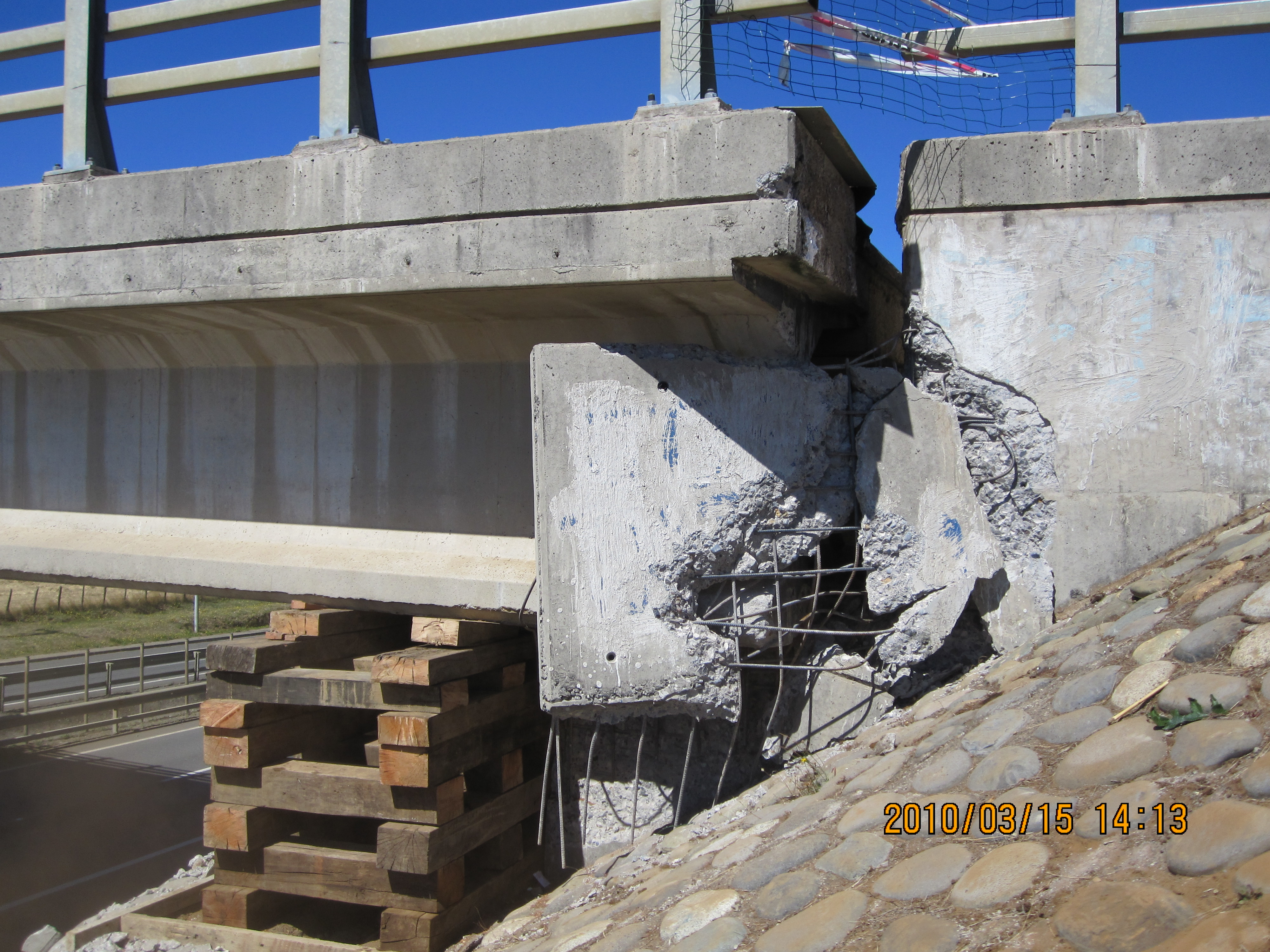
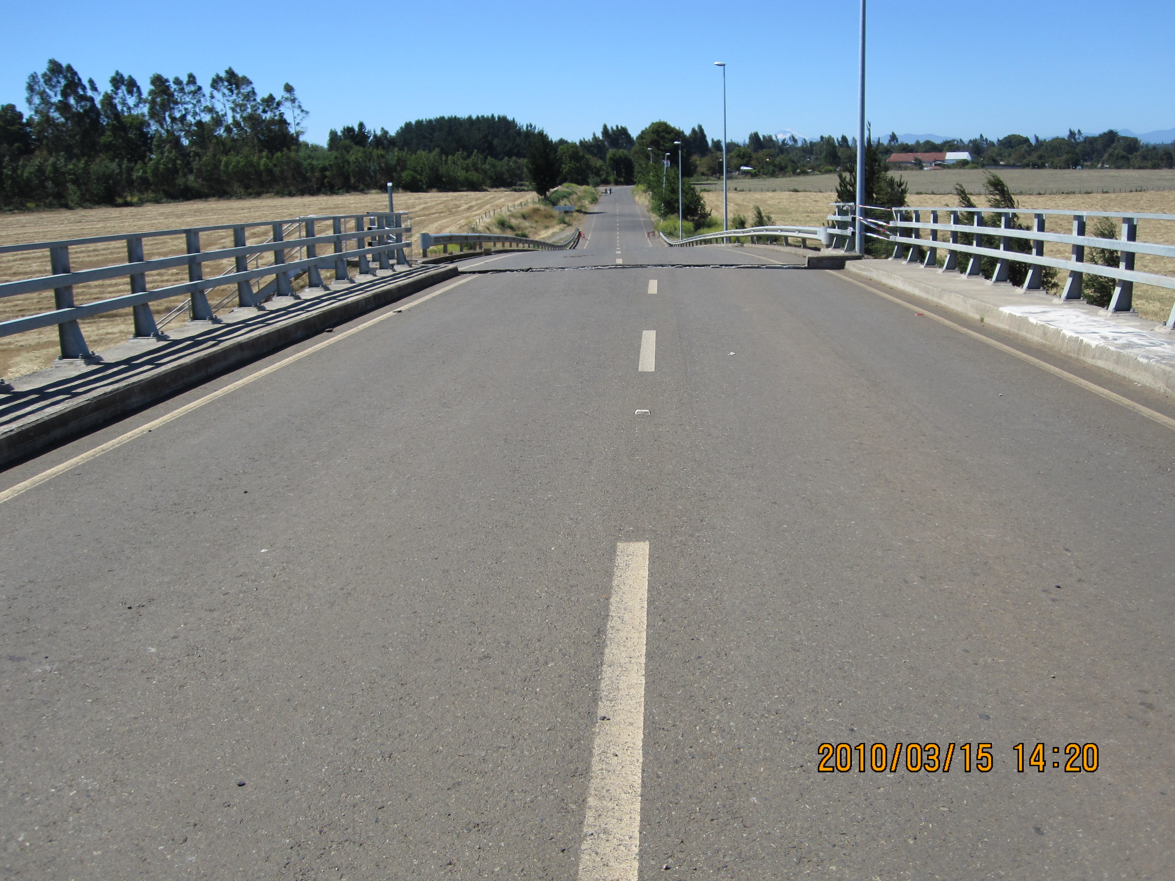
Below are a couple photos of one overpass that really puzzled us. It was closed and on temporary supports. This bridge, just north of Ercilla, rotated about 3-feet at each abutment, to the extent that one girder came completely off of its support (Figure1, Figure 3). What you see in the photos are the offset as you get on the bridge, as well as the girder poking through the shear key at the abutment (Figure 2, Figure 4). Besides trying to figure out why the bridge essentially spun around, the crazy thing was that 3 identical bridges within 2 miles showed absolutely no damage. We will be working on this one.
Today as we traveled along the inland corridor, people we saw were relatively unaffected by the earthquakes. Children were going to school and most businesses were open. We will now take the next 3 days slowly heading back north along the coast to investigate the more heavily damaged bridges in the epicentral region. More tomorrow.
 |
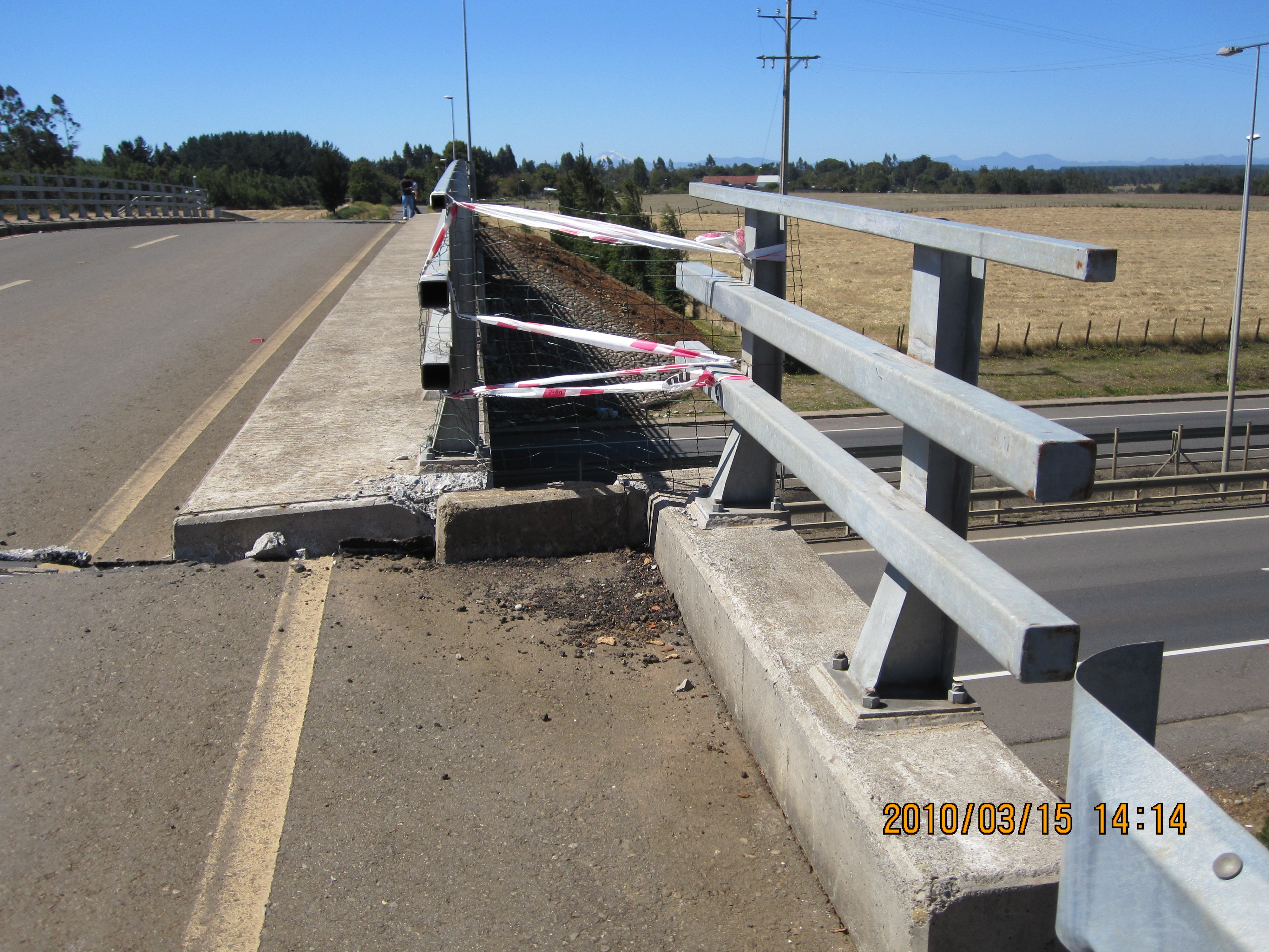 |
| Figure 1. | Figure 2. |
 |
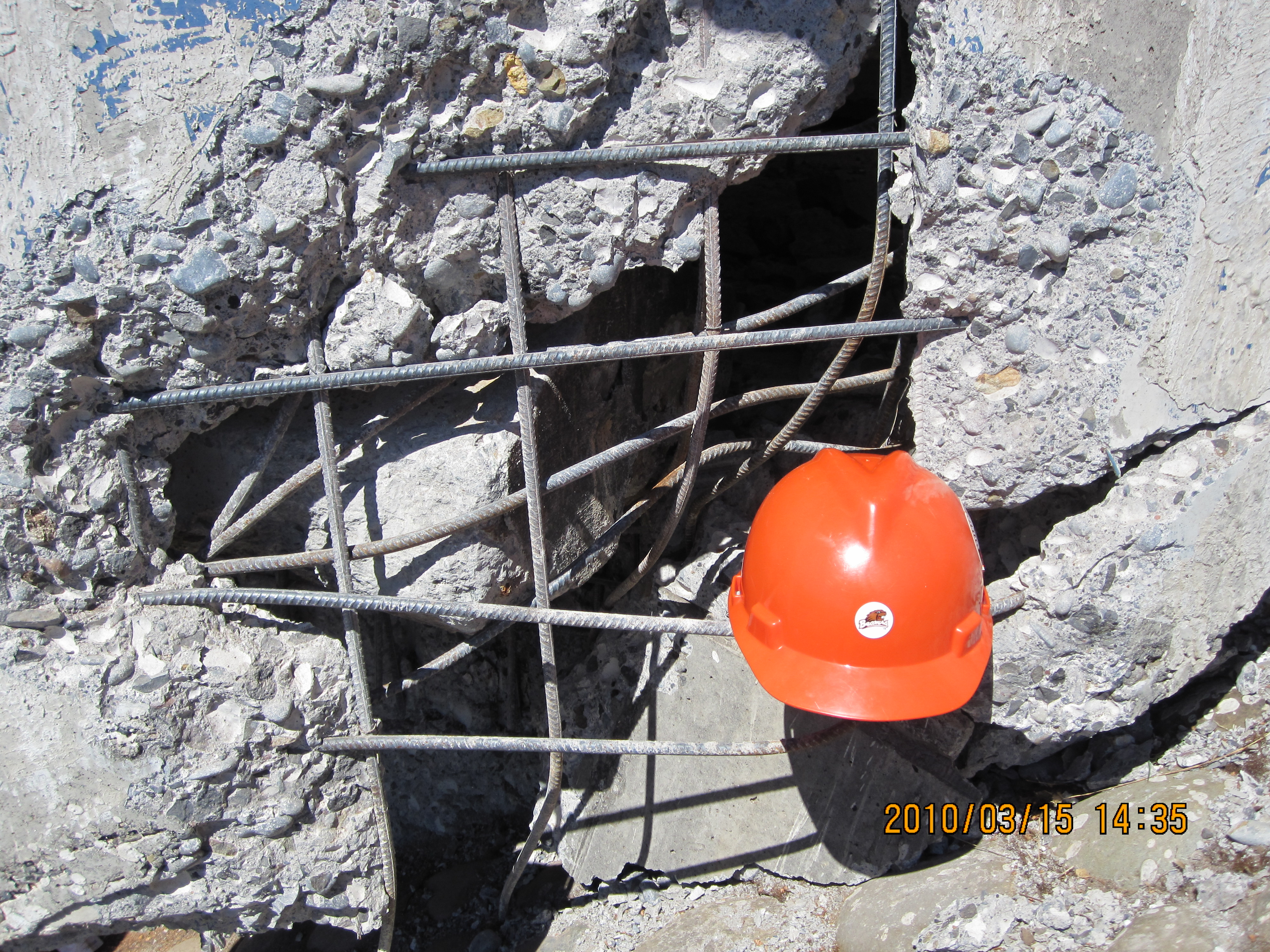 |
| Figure 3. | Figure 4. |