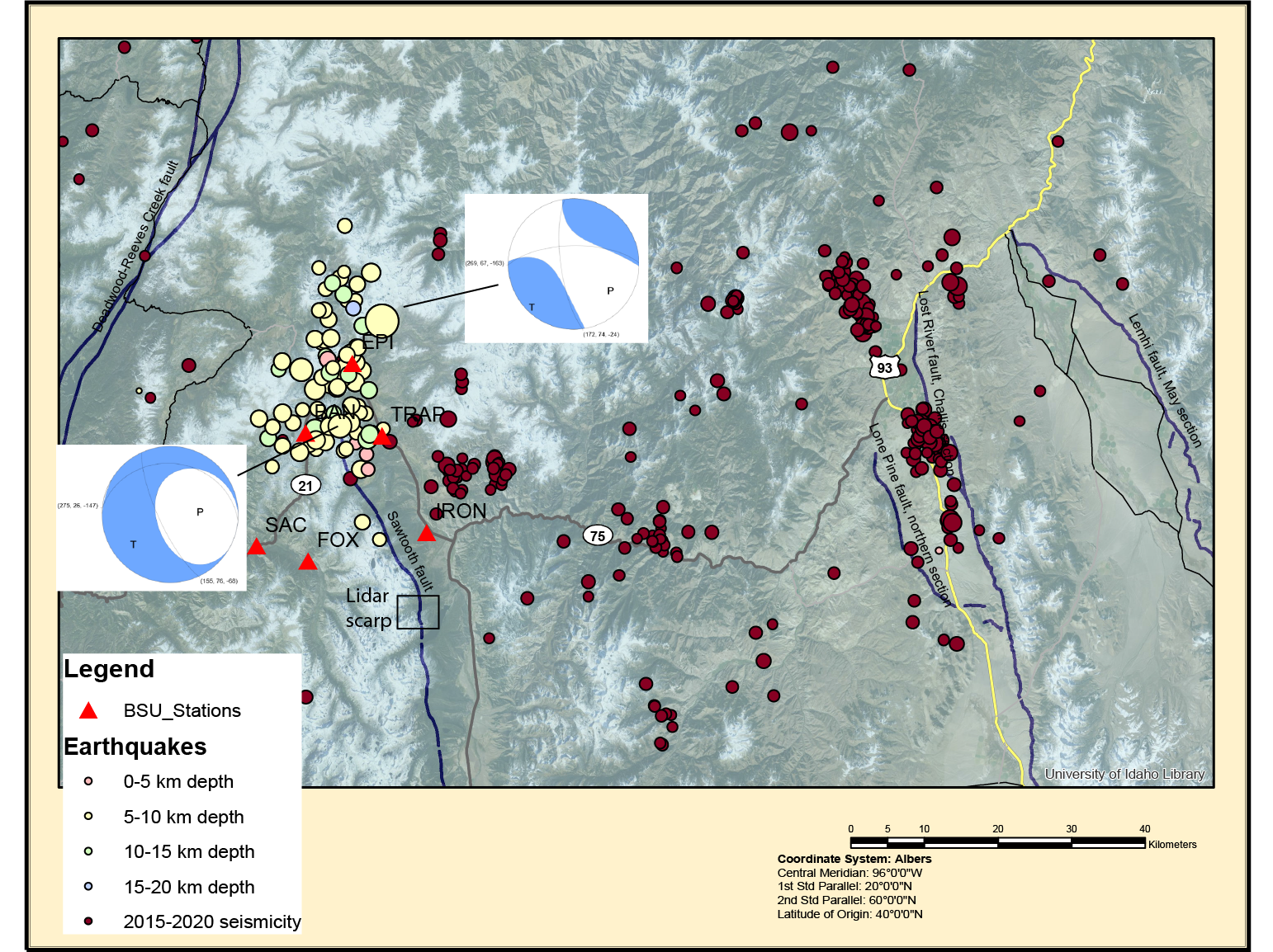
Map of the M6.5 Stanley, ID earthquake. The earthquakes from this week are in color (last updated this 4/3/2020), coded by depth, scaled by magnitude. Two fault plane solutions (M6.5 and M4.6), location of the Holocene scarp (Thackray et al. 2013), faults included in the USGS database, and earthquakes since 2015 (scaled by magnitude) are all shown.