Sahar Derakhshan, Kristen Hess, and Ezra Jampole will be co-curating the housing topic of EERI’s Clearinghouse on the Muisne, Ecuador earthquake. Sahar is an Assistant Specialist at PEER with backgrounds in Public Policy and Structural engineering; Kristen is a PhD student at the University of Colorado Boulder studying sustainable infrastructure materials; Ezra is a PhD student at Stanford University studying methods to reduce damage to light frame housing during earthquakes.
A 7.8-magnitude earthquake struck northern Ecuador at 6:58 pm local time on 16 April 2016. This earthquake, the strongest to hit Ecuador since 1979, was centered on Ecuador’s sparsely populated fishing ports and tourist beaches, 105 miles (170 kilometers) northwest of Quito, the capital (source). The nation’s geophysical institute reported “considerable damage” and said more than 230 aftershocks, had followed (source).
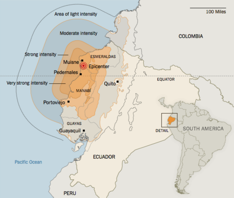
Figure 1. Intensity Map. (Source: USGS)
According to the latest report from Ecuador’s National Secretariat for Risk Management (SNDGR), there have been 443 deaths, 4027 injures, 20,503 people have sought shelter in emergency collective centers, 805 buildings have been destroyed and 608 others have been affected; no official information has been provided on the number of affected people. (SNDGR, 19 Apr 2016)
Ecuadorian Red Cross estimates that the numbers of affected people could reach up to 70,000 and 100,000 and with 3,000 to 5,000 needing emergency shelter (Relief web).
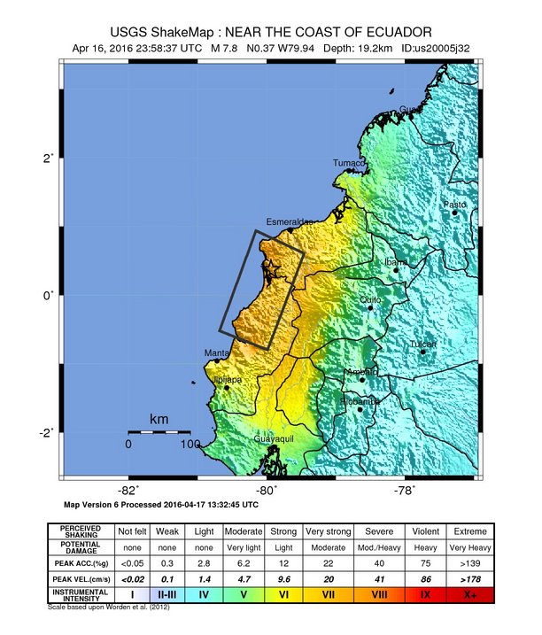
Figure 2. USGS Shake Map.
Figure 2 shows the location of a 7.8 magnitude earthquake near Esmeraldas, some 28km South-southeast of Muisne, near the coast of Ecuador (USGS).
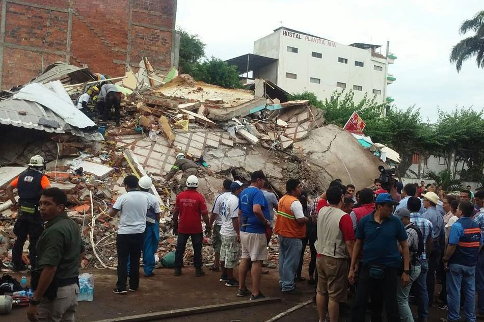
Coastal areas nearest the quake were worst affected, especially Pedernales, a rustic tourist spot with beaches and palm trees, where massive apartment blocks and buildings were completely flattened. (Source)
More damage was reported in the cities of Manta, Portoviejo and Guayaquil. The brick and concrete homes are reduced to rubble along the quake’s path. In the coastal town of Chamanga, authorities estimated than 90 percent of homes had damage (The Associated Press April 17, 2016).
This city of nearly 300,000, the provincial capital of Manabí Province, was hit particularly hard, with officials reporting more than 100 deaths and at least 370 buildings destroyed (NYTimes).
 |
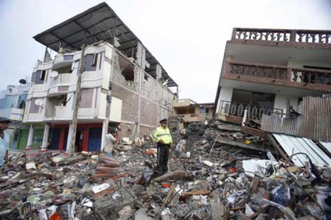 |
| Figure 3. Destruction in Pedernales. (Source) | Figure 4. Destruction in Pedernales. (Source) |