
Figure 1. US EERI Social Science Team in Rikuzen Takada, June 21, 2011 (Photo by H. Chen).
Team Members:
The US EERI team was joined by counterparts from Taiwan and Korea as an international social science and government inspection team hosted through the Institute for Social Safety Science (ISSS). The field reconnaissance planning, situational context, translation and logistics were provided by a diverse group of professors and graduate students from a number of Japanese social science and disaster research institutions. We especially wish to thank the following people for their generous time, gracious hospitality and professional collaboration:
Translators and Logistic:
Our team also appreciates the above and beyond efforts from all of the local governments and related institutions/organizations for their time in preparing documents, providing lectures and participating in question and answer sessions, despite all of the demands from their busy schedules.
Starting Off –We departed from Tokyo on Sunday, June 19th and traveled to Morioka, in north central Tohoku. There we received an evening briefing from Iwate Prefecture government officials on the emergency response and reconstruction proposals. We were told many of the coastal communities have little or no capacity to deal with the overwhelming nature of this disaster and must rely on the assistance from the Prefecture government. Key issues that we are examining are sheltering, temporary housing, support for vulnerable populations, emergency warning and response, economic impacts, debris management and the process of recovery.
Our field reconnaissance began on Monday, June 20th as we traveled along the Sanriku Coastline starting in Northern Iwate Prefecture. Over several days traveled south into Miyagi Prefecture and finished in Natori City on Friday, June 24th . We had scheduled observations or visits in a dozen communities, some large and metropolitan, but many were small and dependent on their fishing ports.
The timing of this reconnaissance was at the 100 day post-event timeline and provided a unique opportunity to see the transition from response into the early stages of recovery planning. Many communities will be working for years on repairs and cleanup operations, but visioning for the reconstruction is already taking place. One of the best aspects of the visit was our ability to interact at the local, prefecture and national government levels and better understand the nature of Japanese disaster management.
The Japanese employ three types of countermeasures for tsunami: 1) defense structures such as coastal dikes, sea walls, and break-waters; 2) tsunami-resistant town structures such as forest buffers, relocating structures to higher elevations or inland, evacuation routes; and 3) soft-wares such as warning and evacuation. We observed and discussed the performance of all of these types of protective activities with public officials and our Japanese colleagues. We were able to note the different approaches to response and recovery between prefectures and saw a large range of capacities between communities at the local level.
Probably the most significant aspect of this event is the fact that a M 9.0 earthquake was not considered possible by a consensus of the scientific community. By not understanding the extreme possibility that this size of event could occur, every other component of disaster management at the local, regional and national level was overwhelmed by the scale of the tsunami. This was the epitome of a low probability and high consequence event.
On an positive note, for the magnitude of this great earthquake, we saw minimal seismic damage on our travels along the coast. Compared to what we might expect to see for a similar event in the Pacific Northwest, Japan faired well from the earthquake itself.
Iwate Prefecture
Day One: Kuji, Noda, Taro, Miyako, Yamada and Ootsuchi
Taro is notable for its massive 10-meter high sea wall built following the 1933 tsunami. It was referred to as the “Great Wall” like in China as it stood between the harbor and most of the city. There was concern that more recent developments that had been permitted outside the main sea wall area would be vulnerable to a larger probable tsunami, and they even installed a lesser sea wall for that area too – but all were overwhelmed from the severity of this great tsunami. We attended a presentation in the city hall with a vivid retelling of one man’s retreat to the third floor and his capturing the overtopping of the main wall with photographs.
In Miyako we received a briefing from a Prefecture official and I investigated the remains of a fire station which housed the area’s warning sirens. In hindsight I wondered what capacity exists now to respond to fires for the remaining non-damaged homes on higher ground. Our last stop that day was in Ootsuchi where we received a briefing from a Prefectural representative on their recovery proposal and then a separate briefing on debris management. We saw a shelter from the outside with a traveling van that provided eye examinations and fitted glasses for tsunami refugees.
Day Two: Kamaishi, Oofunato, Rikuzen Takada and Iwate workshop
Our second day provided our team with views of increasing scales of destruction as we headed south. All along the way we saw clusters of homes, businesses and infrastructure in the rural areas, but it seemed like each city presented more widespread damage.
In Kamaishi we visited with a representative from the port authority on their impacts and business resumption. Our hosts pointed out the damage to the vast tsunami breakwater near the mouth of their harbor. We also stopped by a fish hatchery where we saw evidence of damage to their facilities. Following the earthquake, their two research vessels took immediate action and managed to escape Kamaishi harbor before the tsunami’s arrival. In Oofunato we were given a presentation at their fire station headquarters on preparedness measures. We heard their 12noon testing of the tsunami alert system, which also plays at 7am and 5pm every day.
Rikuzen Takada was impressive for the wide area affected and the mountains of debris being sorted. We attended a briefing outdoors near the shore by a wedge shaped building with bleacher-type seats facing the ocean. We were told it was the office of their Chamber of Commerce and was a designated tsunami evacuation building. According to a recent tsunami survey report from Dr. Shingo Suzuki and others, the inundation level at this building was 12.8 meters. Near by was the City’s debris sorting area with mountains of various materials. There was strong evidence of subsidence along their harbor and inland behind the main highway.
The evening of Day two our team and the Korean and Taiwanese members participated in a workshop hosted by Iwate Prefecture officials asking for listing our findings and recommendations. While we all provided examples, the EERI team will need time to digest all we have seen and provide our thoughts in our upcoming EERI newsletter.
Miyagi Prefecture
Day Three: Ishinomaki
My first impression of Ishinomaki was of all the dead ornamental pine trees in yards and roadsides as we drove through the city. At first i wonderd if salt water had infiltrated the ground water, but I later learned it was from the broad inundation across much of the area. When we arrived at their City Hall, we saw widespread evidence of liquefaction along the sidewalks and there was the pervasive musty smell of flood damage. Inside we learned that City Hall was inundated up to 1.5 meters and the area had standing water for 4-5 days. Employees had to use a makeshift platform to gain access to the building and it took one month to reopen for business. As of June 13th, Ishinomaki had the highest number of people killed (3,025) or still missing (2,770) from the tsunami. They told us 6,000 people were still in shelters. When Dr. Terri Norton inquired about their debris management plan, we were told they estimate it may take 100 years to process based on their annual capacity. Debris had been collected into 19 sites and most was already separated. We surveyed a heavily damaged bayside industrial facility, their fish market area, and then toured a shelter at Minami Elementary School. We finished our day at Ishinomaki Senshu University and learned how the campus hosts the area’s volunteer center with volunteers camping in tents and cars along the roadside.

Figure 7. Nicolle Comafay translates disaster assistance process at Ishinomaki City Hall (Photo by J. Wilson).
Day Four: Minami Sanriku and Kesennuma
For me, Minami Sanriku was the city where I felt the most personal connection to this disaster and the sense of loss was so strong. Maybe it was having seen several online videos of the tsunami tearing through the City, but it was also learning about heroic efforts from the City’s emergency management staff as their operation center was being overwhelmed and the tragic situation at their City hospital, which was flooded up the 4th floor.
After a tour around the harbor by members of the fishing fleet, we were treated to a homemade Hotate (scallop) soup, the last batch from their annual harvest. I was struck by the warm reception we received from this group who were so impacted themselves. At our departure the fishermen all lined up to wave goodbye. As we drove off, the dismal surroundings of the empty city made me think what strong hearts these people must have to endure so much and remain there to carry on. It was almost too much for me just being there for a few hours. At a presentation later that day from a Prefecture-level recovery team, we learned Minami Sanriku estimates 700,000 tons of debris to be cleared, sorted and reused, recycled or disposed of.
In Kesennuma, we met with the manager of the City’s business district. He gave us an evening tour of the devastated fishing market and we saw evidence of subsidence with many blocks having standing water during the high tide. Before saying goodbye, he led our bus on a tour around the dark and empty business district as he described a range of plans for the area’s recovery. He expressed optimism that because his business and home were both destroyed, he now had more time to dedicate to his hobby of painting and shared a beautiful post card he made of Kesennuma harbor.
Day Five: Sendai and Natori City
Our last day in the field was in Sendai, the Prefectural center. In the morning we met with Welfare Association for the Disabled and the Japan Disability Forum. The representatives painted a desperate picture of tens of thousands of disabled residents along the Miyagi coast, but only 2,000 have been located and receiving assistance. The institutions and support networks are broken and due to privacy laws, they are unable to access records to better locate and track displaced people with disabilities.
During our lunch stop several team members surveyed an earthquake damaged condominium that had one tower leaning out of plumb. We were told there would be efforts to repair the work, but it would likely take years for completion.
At prefecture headquarters we met with Mr. Takehiro Mori from the National Disaster Management office. He explained they are working from the Local Disaster Response Headquarters, which is similar to a FEMA Joint Field Office. Typically their office works from Tokyo, but he expected this co-located office in the Prefecture would become more of the standard. Because the scale of this disaster is so vast over multiple prefectures, they could only operate from one prefecture headquarters and he admitted that other affected prefectures like Iwate to the north was not receiving the same level of support due to limited resources.
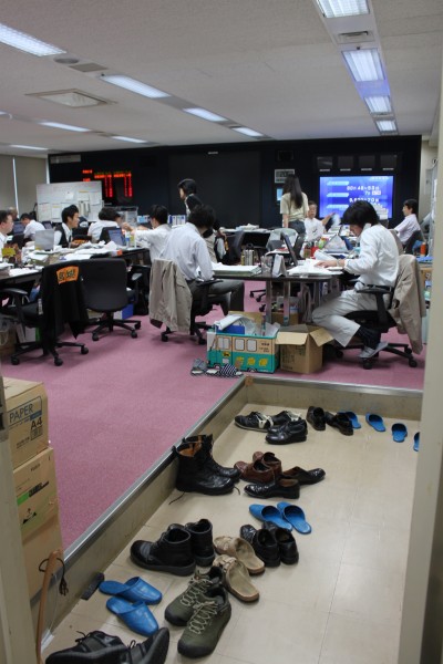
Figure 12. National Emergency Operations Center co-located in Miyagi Prefecture Headquaters (Photo by J. Wilson).
We concluded our last day in Natori City and got a briefing on their damages and initial steps to develop and adopt a recovery plan. It was impressive to see the level of detail and the emphasis on visioning a new future. We toured an area called Yuriage, that many people around the world saw on television as the helicopter camera tracked the initial tsunami surge engulfing green-houses, slamming into elevated roadways carrying vehicles and quickly penetrating up into adjacent canals. Dr. Shunichi Koshimura was very gracious to accompany us on our tour and answer many complex questions about tsunami hazard modeling and evacuation planning.

Figure 13. Flowers in memory of tsunami victims at a shrine on Hiyori Yama in Yuriage (Photo by J. Wilson).
On Saturday, June 25th, we returned to Tokyo for a concluding workshop to develop research proposal ideas and international research partnerships. We learned this event is responsible for the loss of 270,000 housing units. Because sea walls and breakwaters are vital for harbor protection, many communities remain vulnerable now as typhoon season ramps up. It will be a challenge to find ways to take urgent protective measures that tie into and build on the emerging long-term recovery plans.
Speaking for myself, I return to Oregon with a new-found sense of purpose to bring these observations and lessons home and to try to elevate risk reduction measures and pre-disaster recovery planning in the Pacific Northwest. Many of the lessons on vulnerable populations, response capacity, and the transitioning of sheltering into temporary housing and then community reconstruction can apply to any number of disaster situations as well.


