On April 16, 2016 a 7.8M earthquake struck the central coast of Ecuador. More than 650 people were killed and 4,605 people were injured during the first 72 hours. Over 22,420 people lost their homes and 166 schools presented medium to severe damage according to the Secretariat for Risk Management of Ecuador.
Ductile reinforced concrete frame structures behave properly during an earthquake when nonstructural damage is also considered during the design process. This system is a common practice in Ecuador, however the lack of capacity protected-based design procedures influenced most of the reported collapses in low rise buildings and houses, where structural engineers are not usually included throughout the design and construction phases.
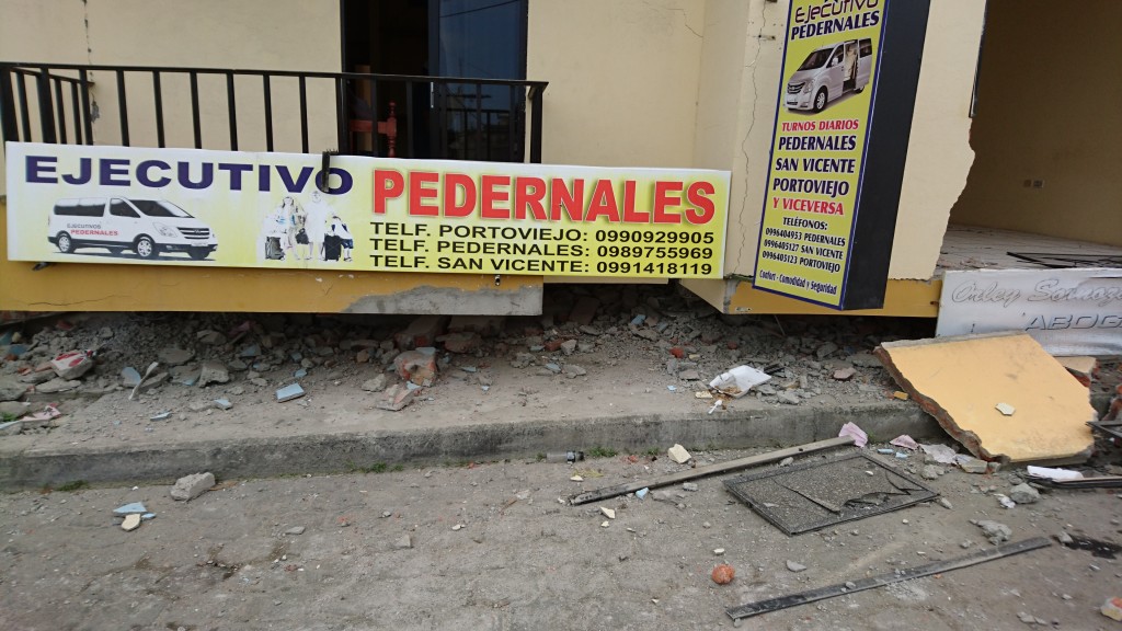
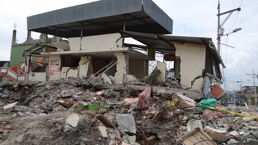
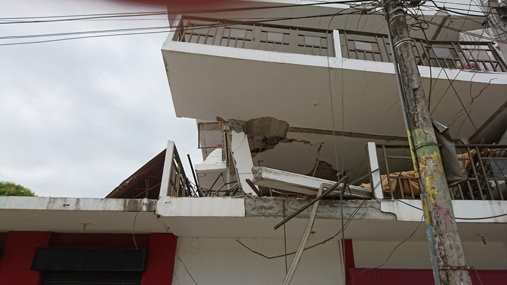
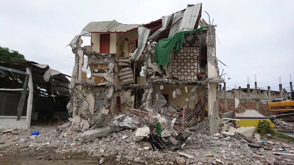
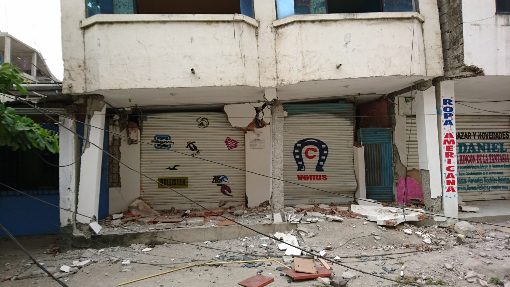
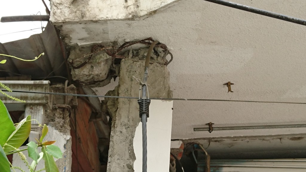
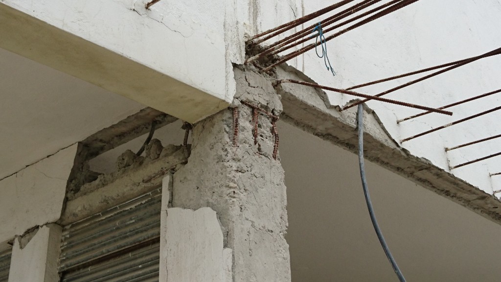
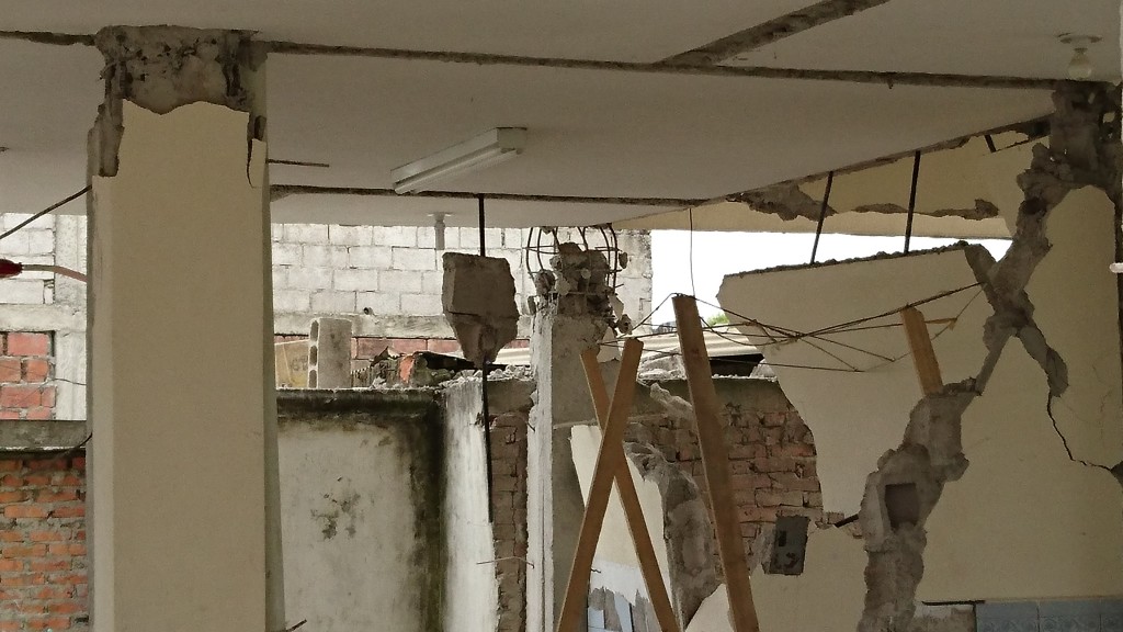
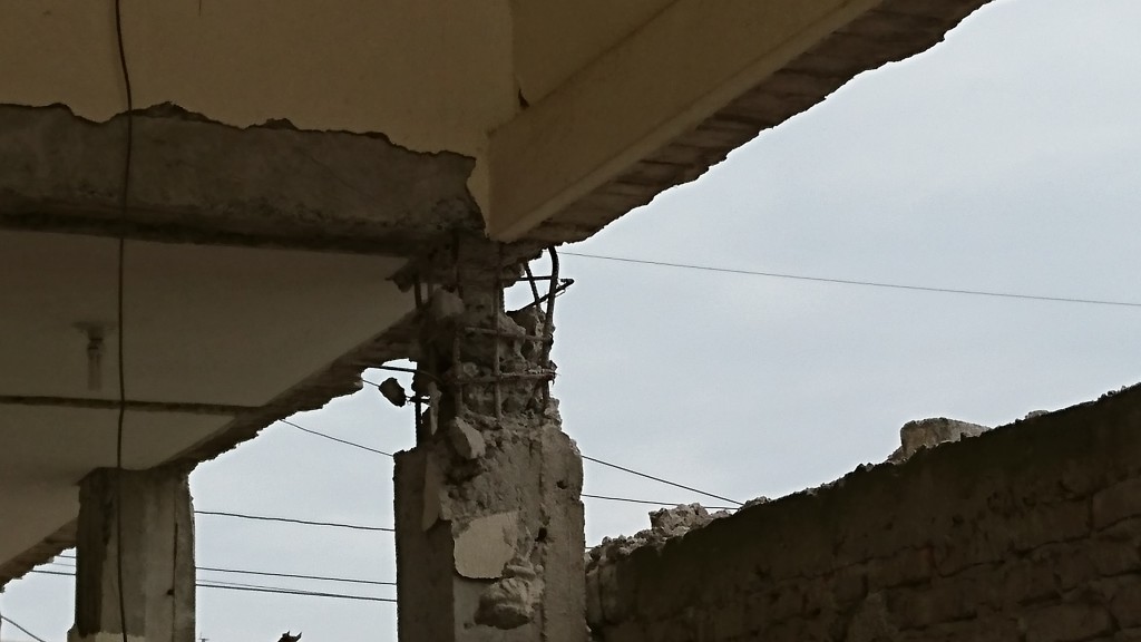
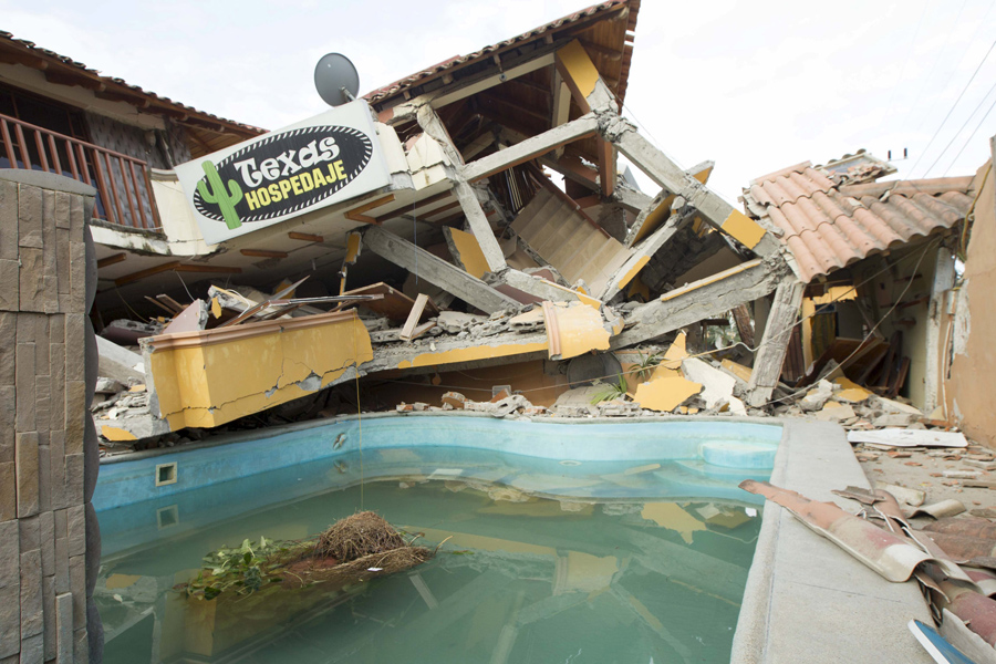
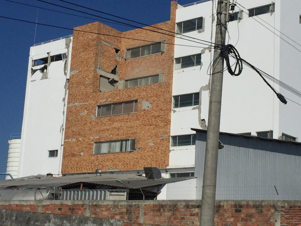
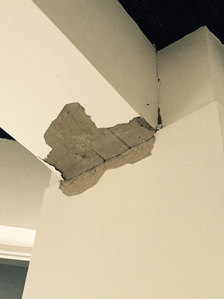
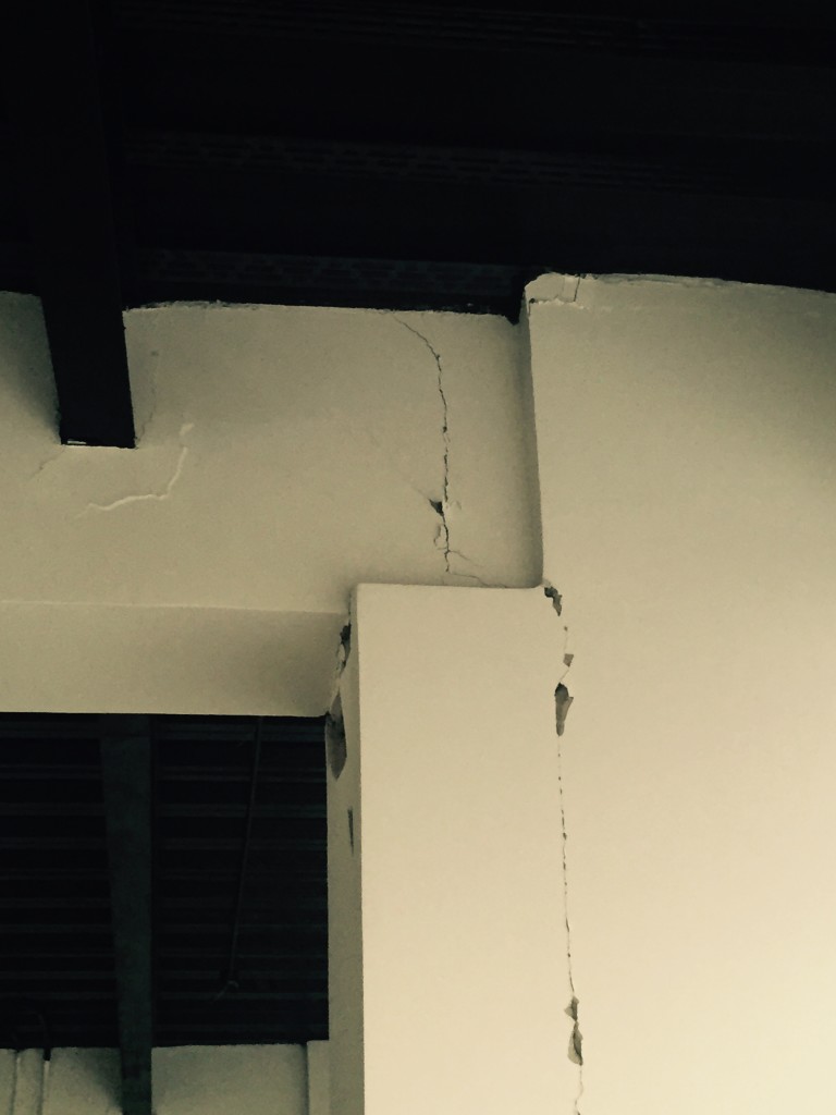
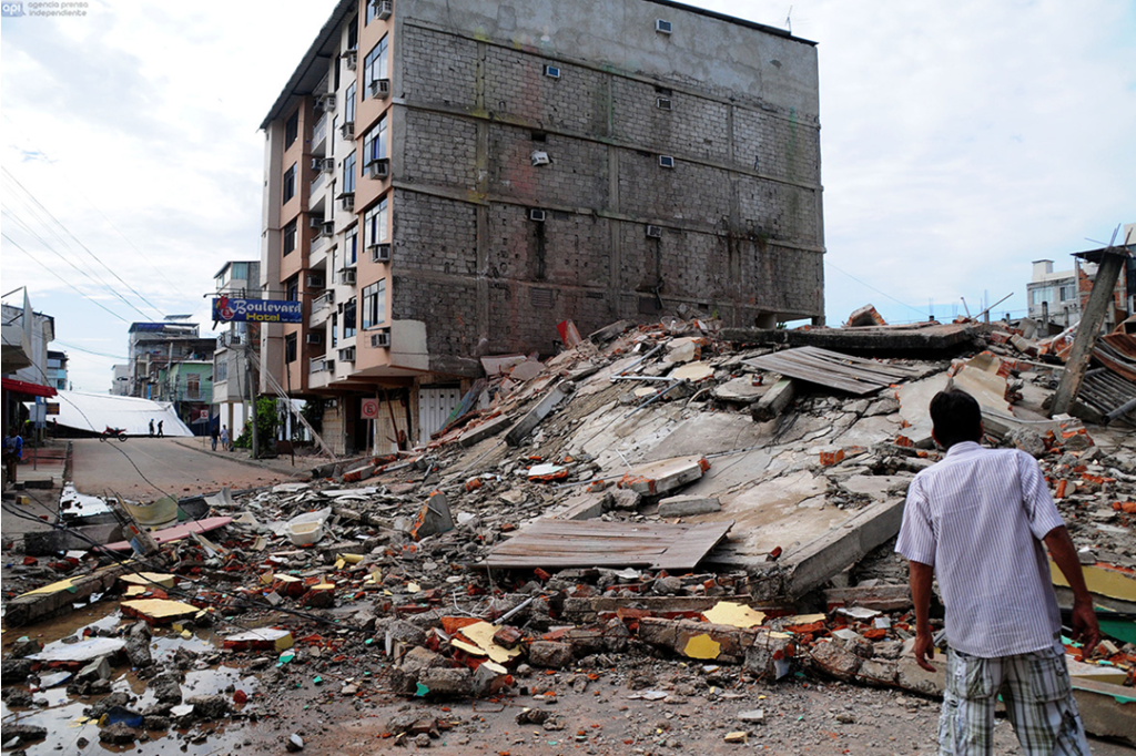
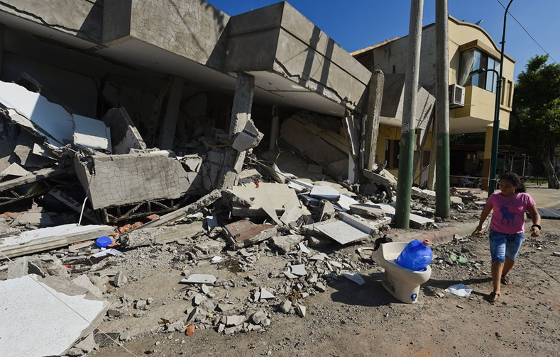
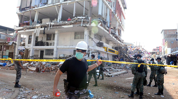
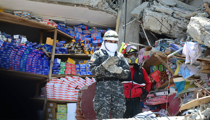
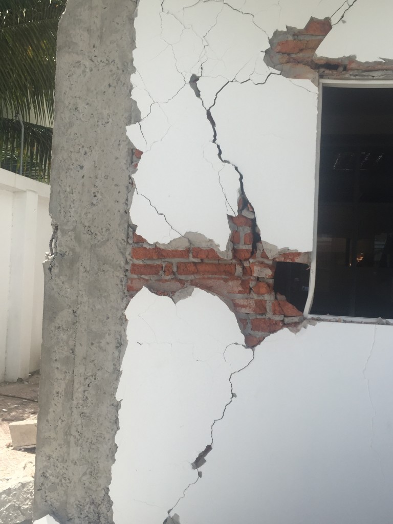
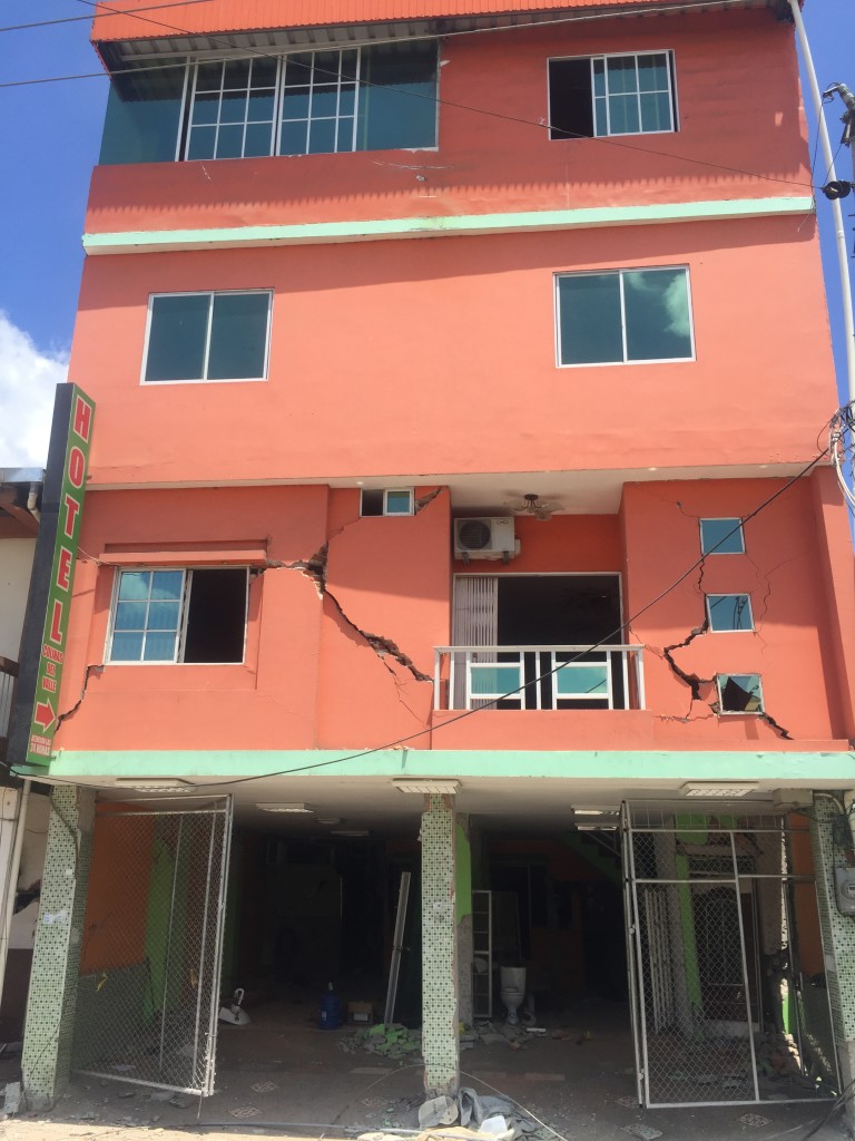
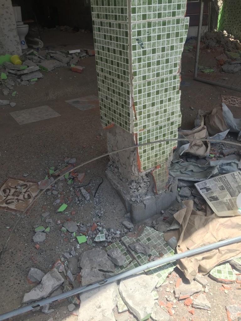
Pedernales is a tourist town located 22 miles from the epicenter, is one of the most affected areas. About 80% of the infrastructure and buildings were affected there. The following pictures show part of the damage captured in this town, in which the lack of detailing is evident.
 |
 |
 |
| Figure 1. Courtesy of Consult Geo, Ecuador. | Figure 2. Courtesy of Consult Geo, Ecuador. | Figure 3. Courtesy of Consult Geo, Ecuador. |
 |
 |
 |
| Figure 4. Courtesy of Consult Geo, Ecuador. | Figure 5. Courtesy of Consult Geo, Ecuador. | Figure 6. Courtesy of Consult Geo, Ecuador. |
 |
 |
 |
| Figure 7. Courtesy of Consult Geo, Ecuador. | Figure 8. Courtesy of Consult Geo, Ecuador. | Figure 9. Courtesy of Consult Geo, Ecuador. |
 |
 |
 |
| Figure 10. Courtesy of Consult Geo, Ecuador. | Figure 11. Courtesy of Consult Geo, Ecuador. | Figure 12. Courtesy of Consult Geo, Ecuador. |
 |
 |
 |
| Figure 13. Courtesy of Consult Geo, Ecuador. | Figure 14. Courtesy of Consult Geo, Ecuador. | Figure 15. Courtesy of Consult Geo, Ecuador. |
 |
 |
 |
| Figure 16. Courtesy of Consult Geo, Ecuador. | Figure 17. Semanario La Prensa. | Figure 18. The Atlantic. |
 |
 |
|
| Figure 19. The Atlantic. | Figure 20. The Atlantic. | |
Video: https://youtu.be/okCsJJNibHM – El Universo (www.eluniverso.com).
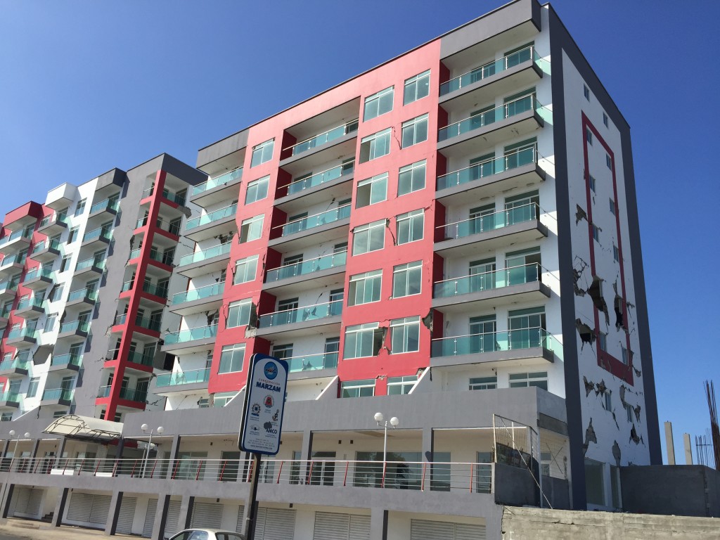
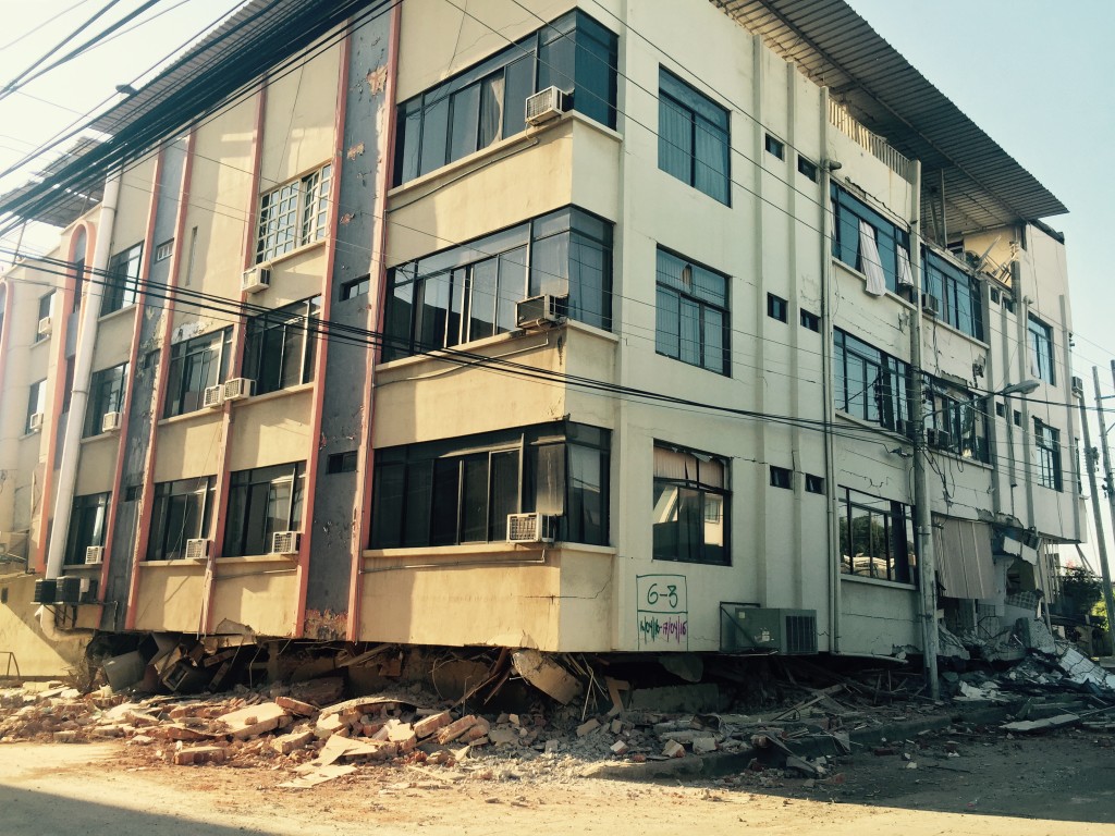
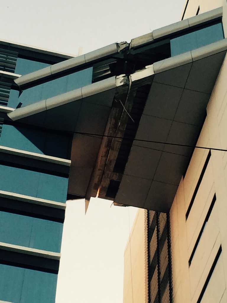
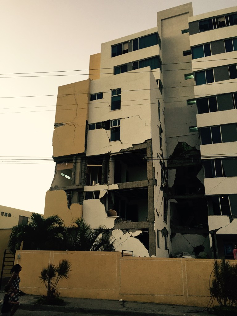
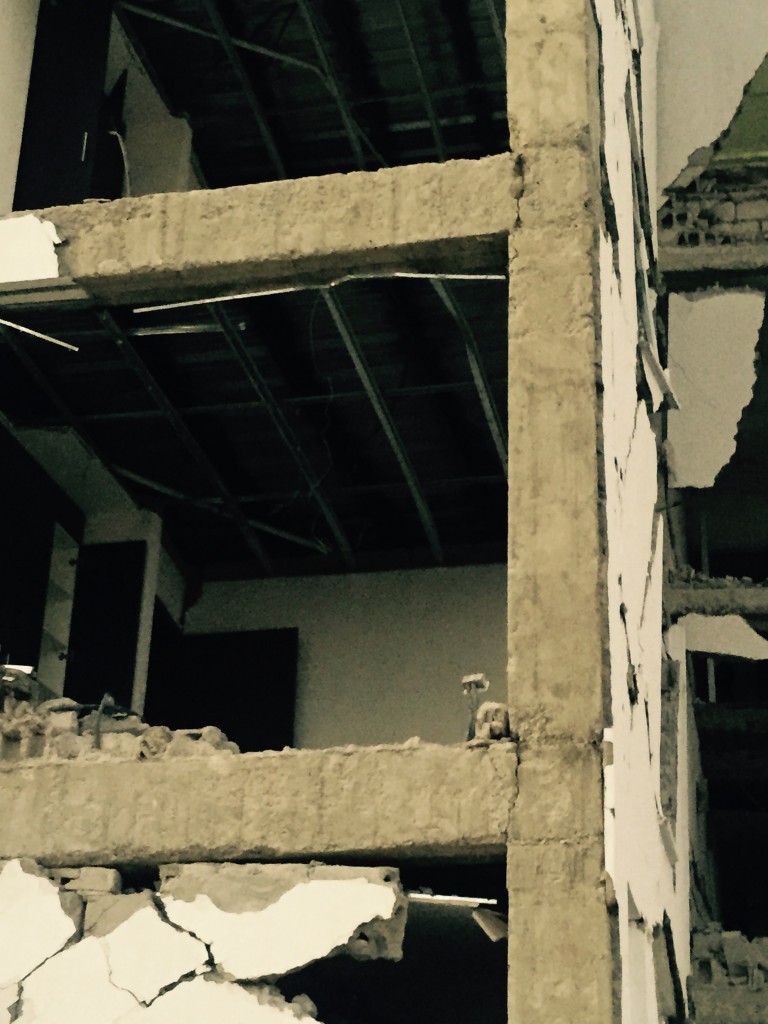
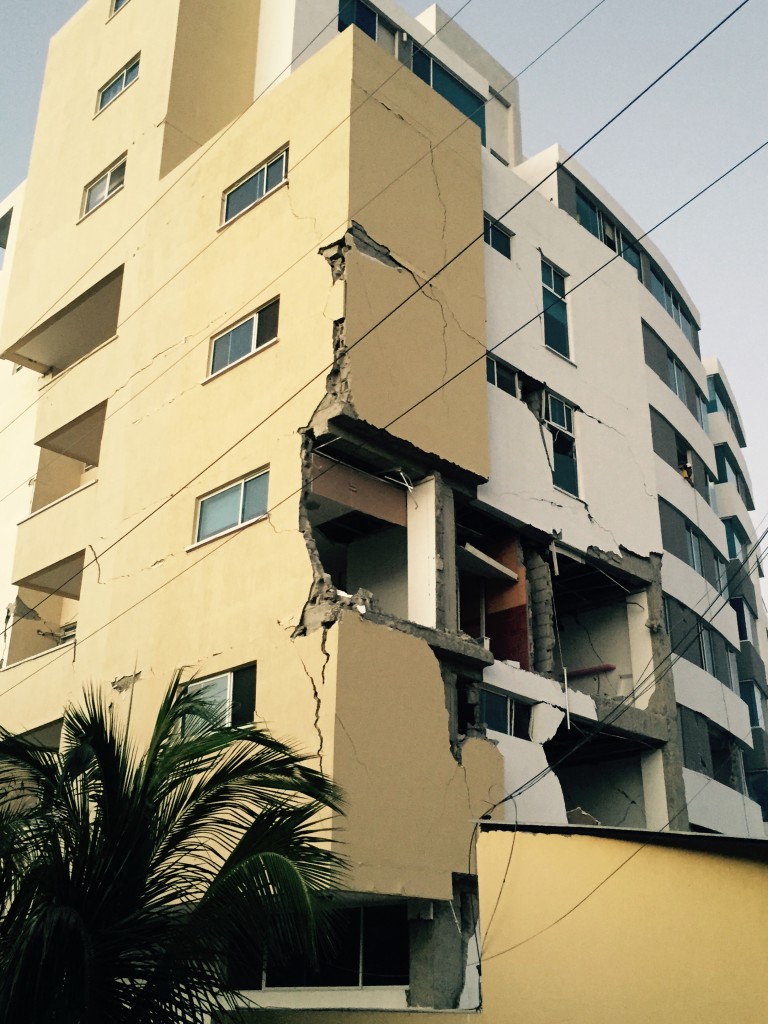
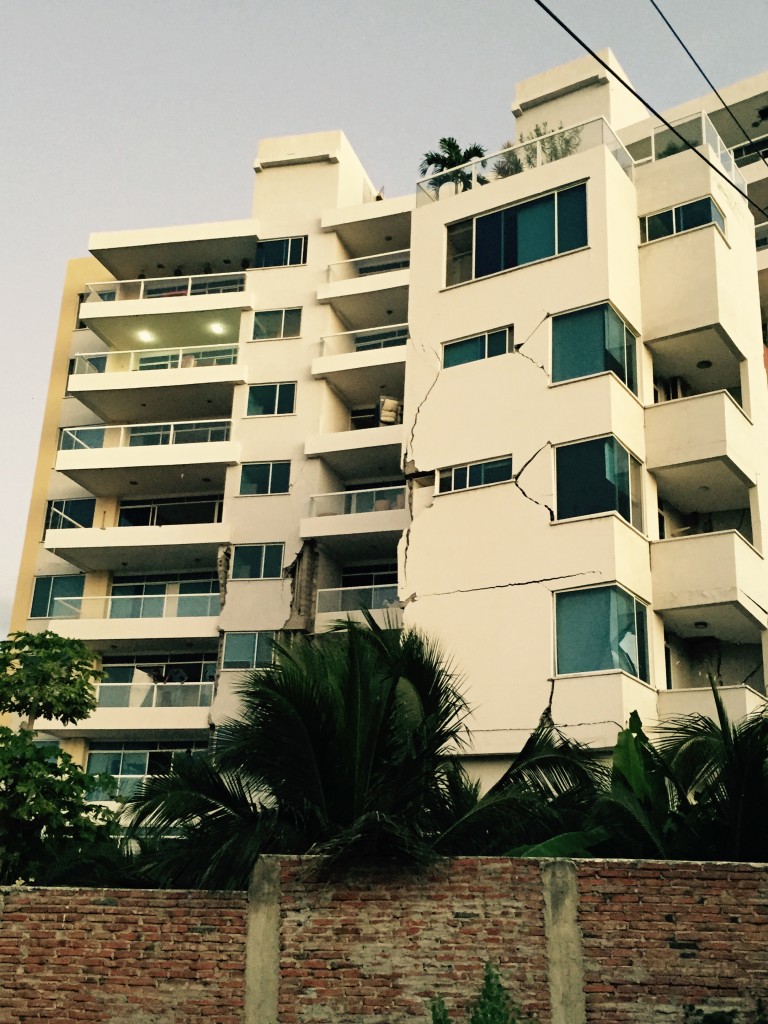
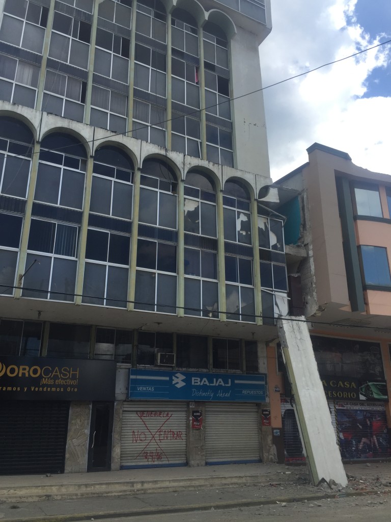
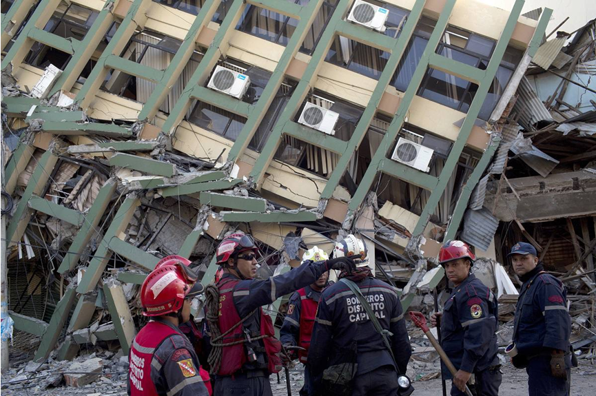
Manta, on the other hand, is a modern city located 107 miles from the epicenter. Some of its medium high rise reinforced concrete frame buildings reported nonstructural damage. Low rise buildings like the most important public hospital in the city has being declared unsafe and probably will be demolish once the evaluations conclude.
 |
 |
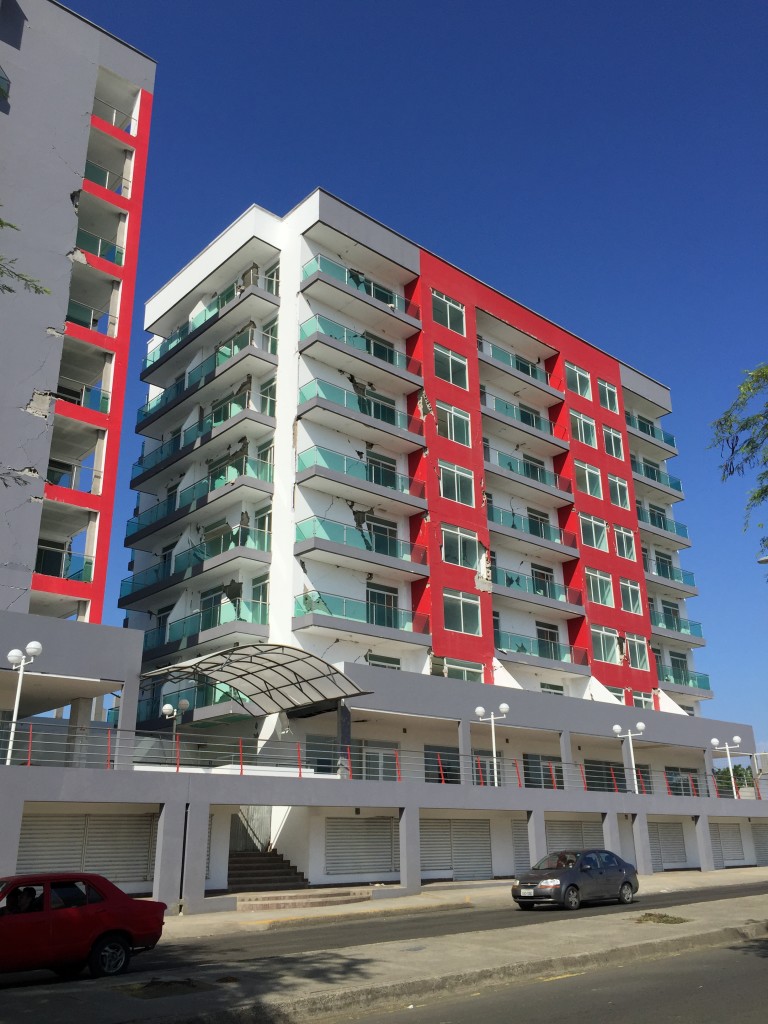 |
| Figure 1. Courtesy of Vinicio Suarez. | Figure 2. Courtesy of Vinicio Suarez. | Figure 3. Courtesy of Vinicio Suarez. |
 |
 |
 |
| Figure 4. Courtesy of Vinicio Suarez. | Figure 5. Courtesy of Vinicio Suarez. | Figure 6. Courtesy of Vinicio Suarez. |
 |
 |
 |
| Figure 7. Courtesy of Vinicio Suarez. | Figure 8. Courtesy of Vinicio Suarez. | Figure 9. Courtesy of Vinicio Suarez. |
 |
 |
 |
| Figure 10. Courtesy of Vinicio Suarez. | Figure 11. Courtesy of Vinicio Suarez. | Figure 12. Courtesy of Vinicio Suarez. |
 |
 |
 |
| Figure 13. Courtesy of Vinicio Suarez. | Figure 14. Courtesy of Vinicio Suarez. | Figure 15. Courtesy of Vinicio Suarez. |
 |
 |
 |
| Figure 16. Courtesy of Vinicio Suarez. | Figure 17. Courtesy of Vinicio Suarez. | Figure 18. Courtesy of Vinicio Suarez. |
 |
 |
 |
| Figure 19. Courtesy of Vinicio Suarez. | Figure 20. Courtesy of Vinicio Suarez. | Figure 21. Courtesy of Vinicio Suarez. |
 |
 |
 |
| Figure 22. Courtesy of Vinicio Suarez. | Figure 23. Courtesy of Vinicio Suarez. | Figure 24. Courtesy of Vinicio Suarez. |
 |
 |
 |
| Figure 25. Courtesy of Vinicio Suarez. | Figure 26. Courtesy of Vinicio Suarez. | Figure 27. Courtesy of Vinicio Suarez. |
 |
 |
 |
| Figure 28. Courtesy of Vinicio Suarez. | Figure 29. Courtesy of Vinicio Suarez. | Figure 30. Photo by IBT News |
 |
 |
 |
| Figure 31. Photo by The Guardian. | Figure 32. Photo by El Universo. | Figure 33. Photo by El Universo. |
 |
 |
 |
| Figure 34. Photo by El Universo. | Figure 35. Photo by El Universo. | Figure 36. Photo by IESS Hospital. (IESS) |

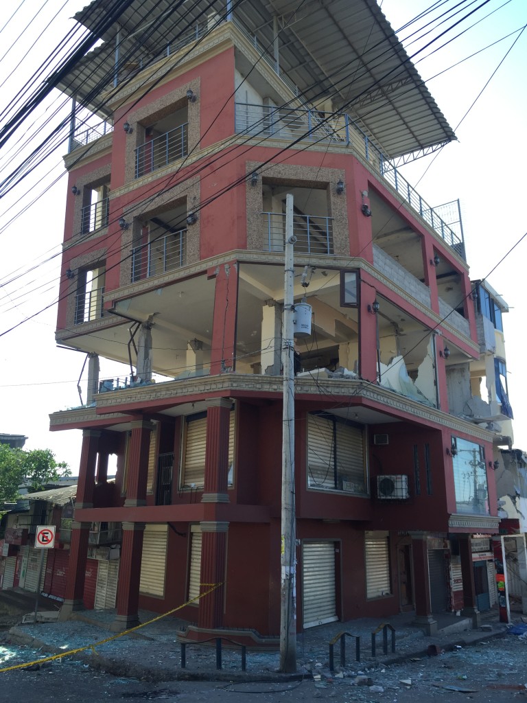
Portoviejo, capital of Manabí (province), is a big city located 105 miles from the epicenter. Low to medium rise buildings presented significant damage as noticed in the following pictures.
 |
 |
 |
| Figure 1. Courtesy of Vinicio Suarez. | Figure 2. Courtesy of Vinicio Suarez. | Figure 3. Courtesy of Vinicio Suarez. |
 |
 |
 |
| Figure 4. Courtesy of Vinicio Suarez. | Figure 5. Courtesy of Vinicio Suarez. | Figure 6. Courtesy of Vinicio Suarez. |
 |
 |
 |
| Figure 7. Courtesy of Vinicio Suarez. | Figure 8. Courtesy of Vinicio Suarez. | Figure 9. Courtesy of Vinicio Suarez. |
 |
 |
 |
| Figure 10. Courtesy of Vinicio Suarez. | Figure 11. Courtesy of Vinicio Suarez. | Figure 12. Photo by CB 24 NOTICIAS CENTROAMERICA |
 |
||
| Figure 13. Photo by El Universo. | ||
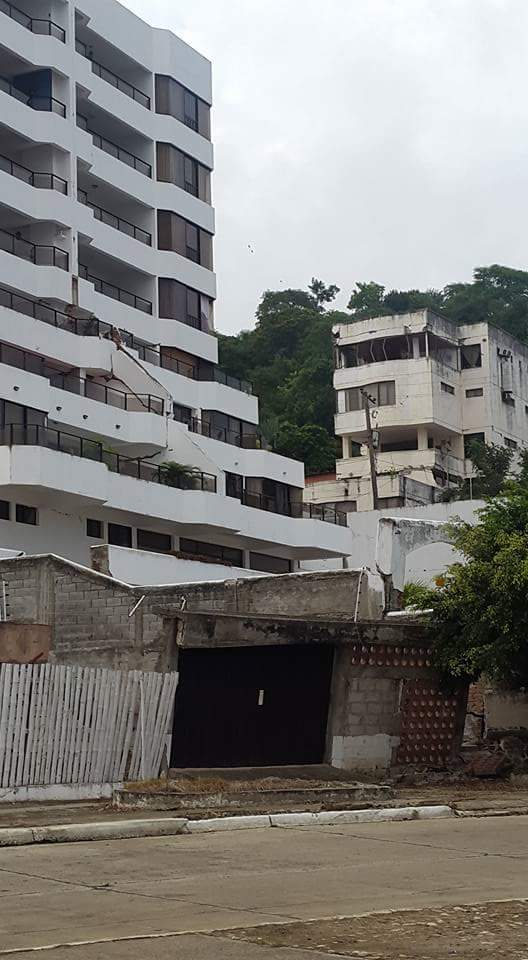
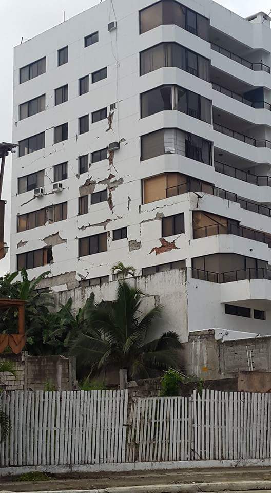
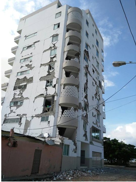
Bahía de Caráquez is a small city located 76 miles from the epicenter, where some medium rise buildings reported damage on infill walls, other collapsed or partially collapsed, and some low rise buildings suffered severe damage.
 |
 |
 |
| Figure 1. Photo from FB. | Figure 2. Photo from FB. | Figure 3. Photo from FB. |
 |
Figure 5. Photo from FB. |
 |
| Figure 4. Photo from FB. | Figure 6. Photo by El Universo (Jorge Peñafiel) | |
More evidence of the damage is being collected at the time this post was published.
