“Google Earth has updated the 3D imagery for part of Kumamoto with imagery captured after the event. The extent of the damage to buildings is clear because the roofs have been patched with light blue tarpaulin that is highly visible.” (Google Earth Blog)
Google Earth has also created a tour of the area showing all the light blue roofs, which can be viewed in Google Earth with this KML file![]() or in the YouTube video.
or in the YouTube video.
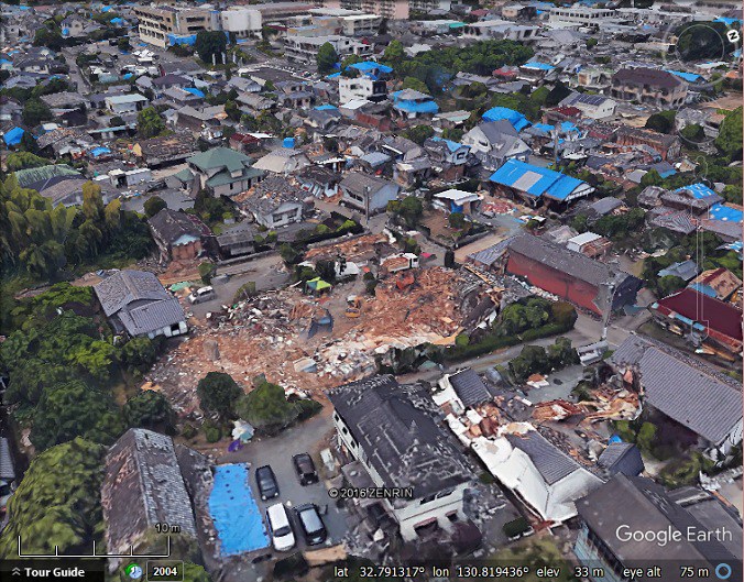
Figure 1. “The suburb of Mashiki was the worst hit, and many houses are damaged beyond repair“. (Google Earth Blog)