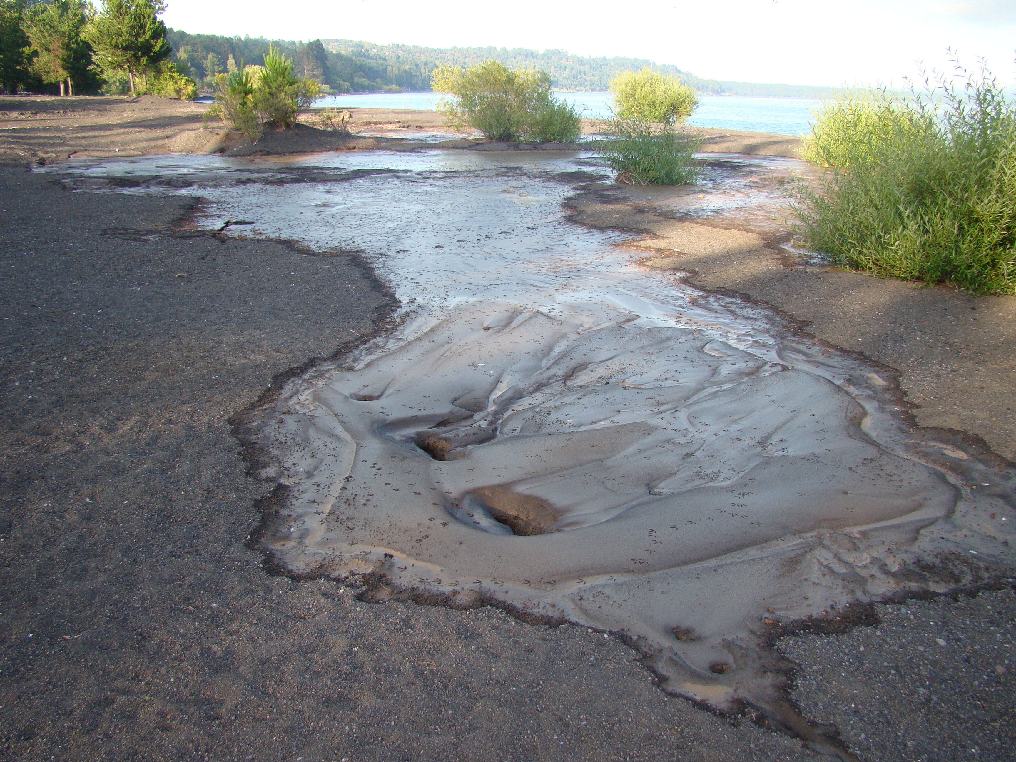
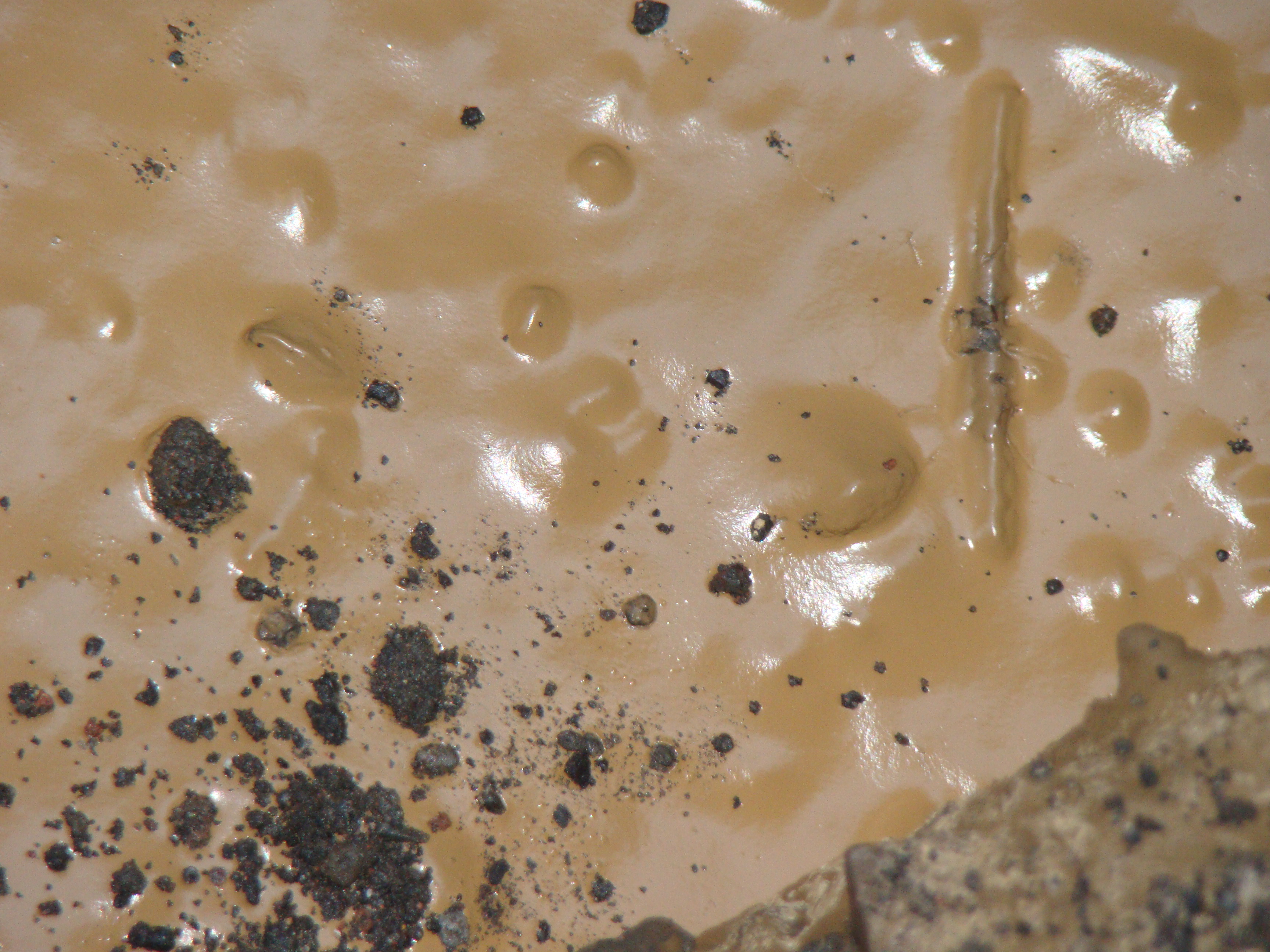
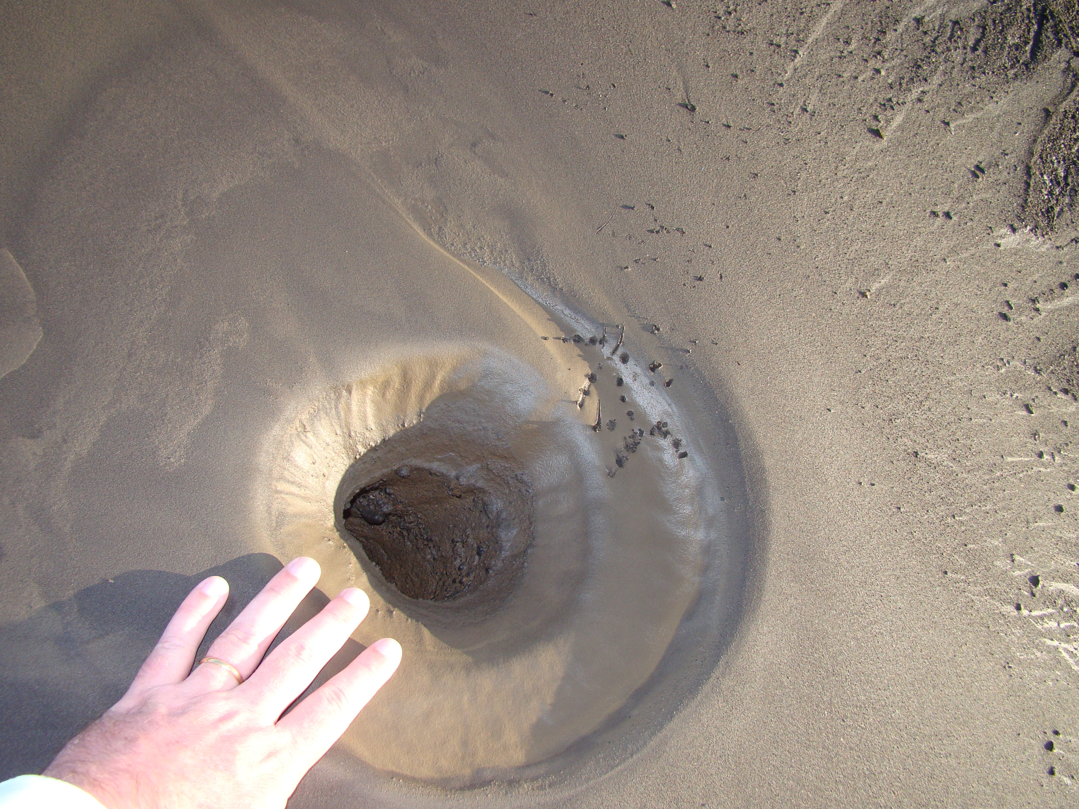
About 5 hours after the earthquake I went down to the shore of the Villarrica Lake Temuco, and observed a very strange phenomena. Some googling showed that a possible explanation is soil liquefaction.
This was later confirmed by Lisa Wald from USGS who recommended posting on this website. On some places at the beach, which is essentially very dark almost black sand from volcanic origin (Villarica Volcano is about 13 km away), some large lighter zones became visible. A closer look revealed that the sand at these spots was mixed with some light brown colored type of soil and it looked like bubbles came up from the ground and bursted at the surface leaving some pretty well formed mostly circular holes (Figures 1, 2 and 3).
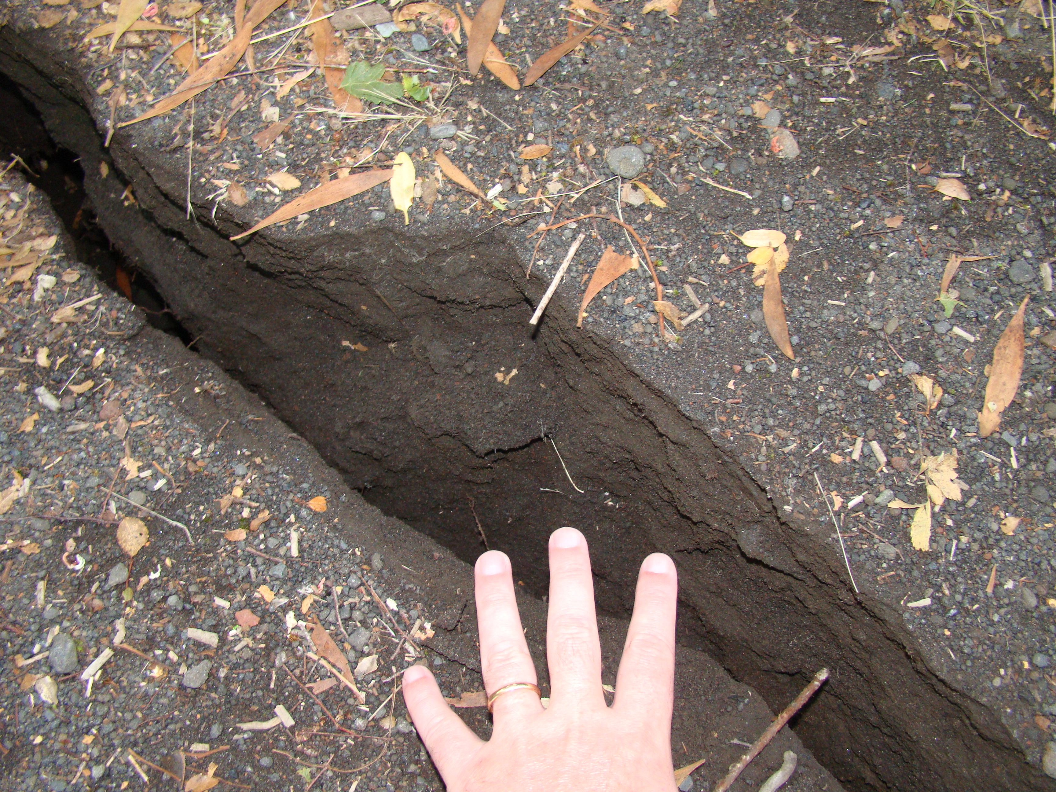
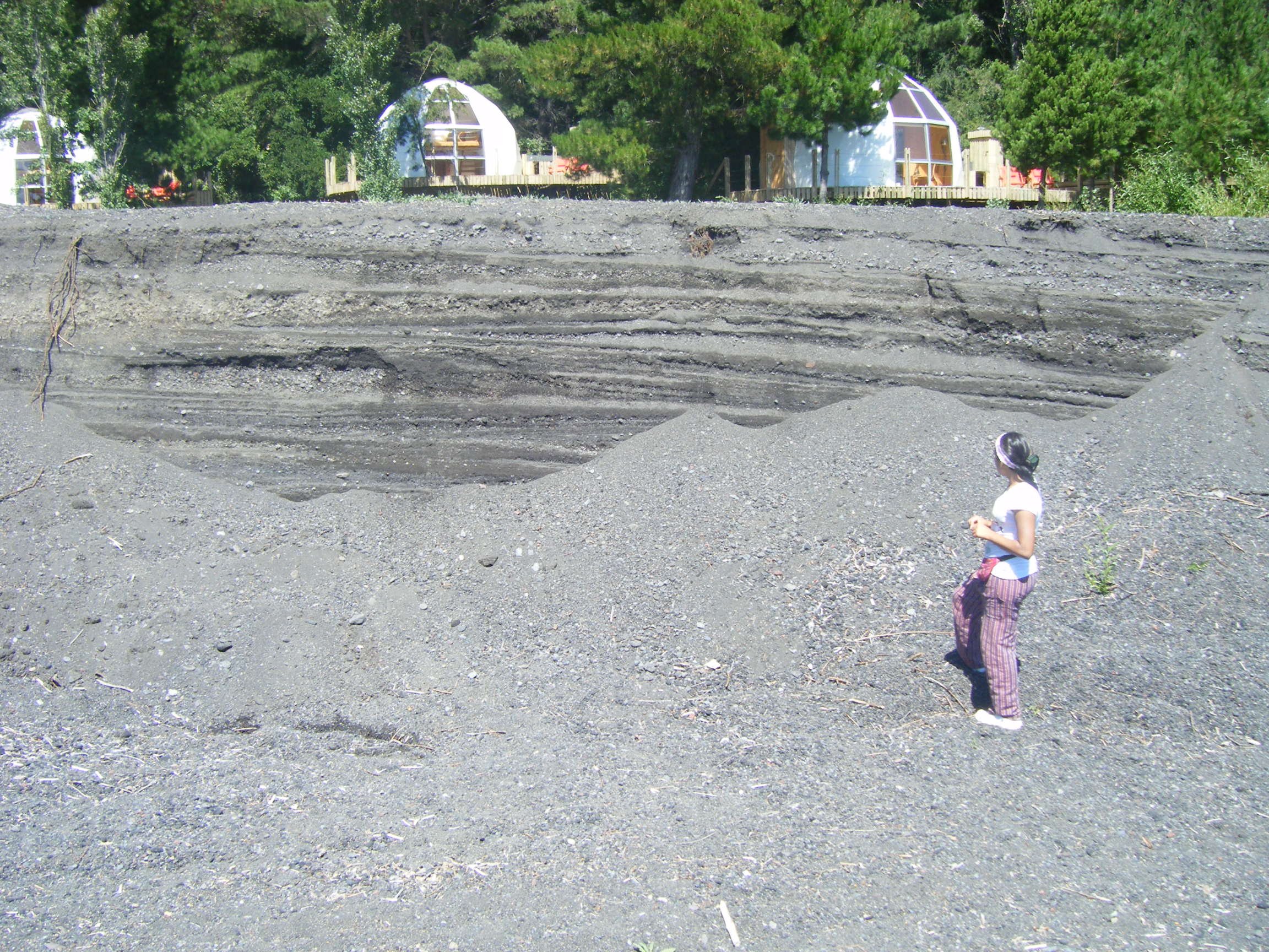
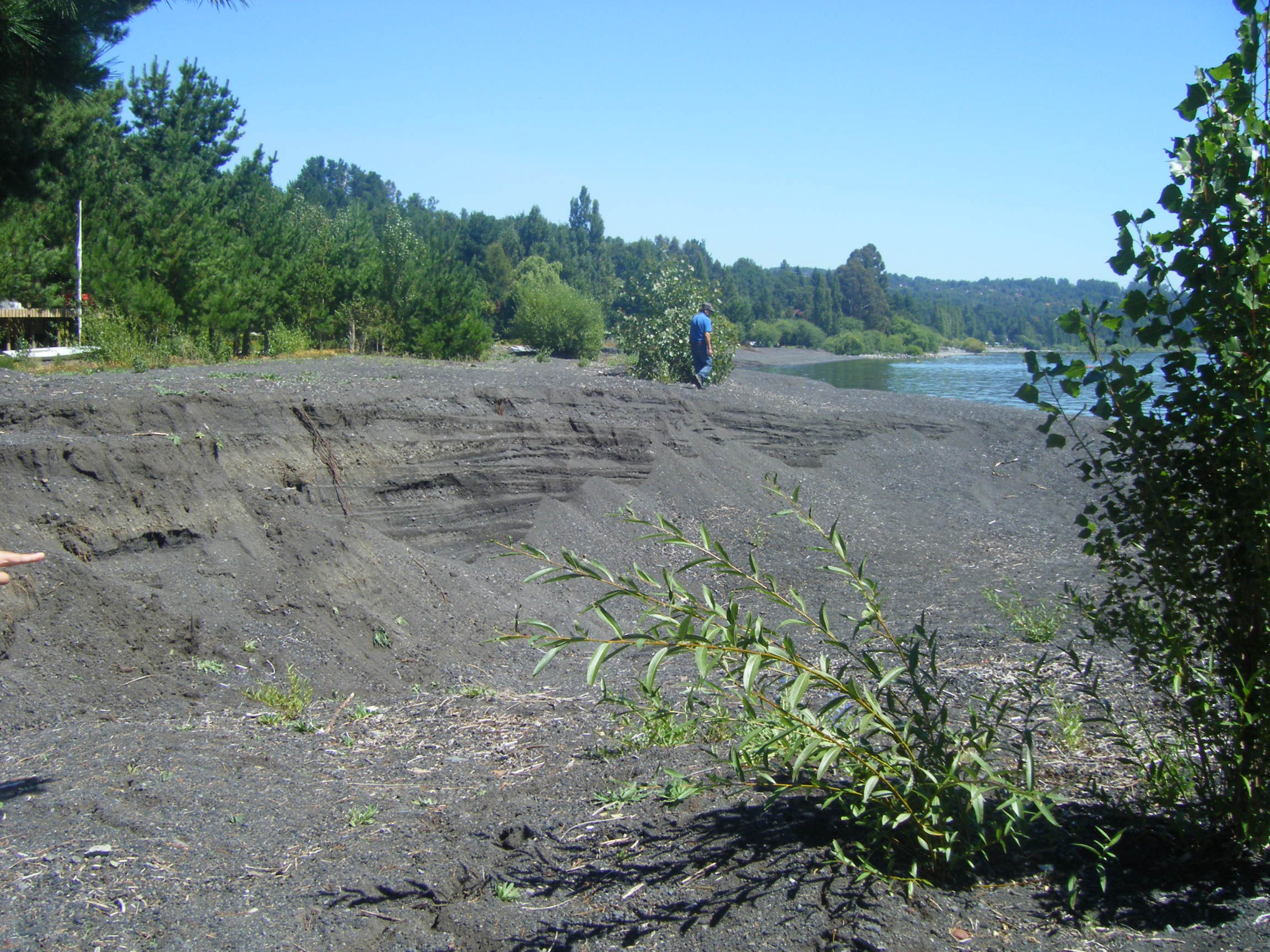
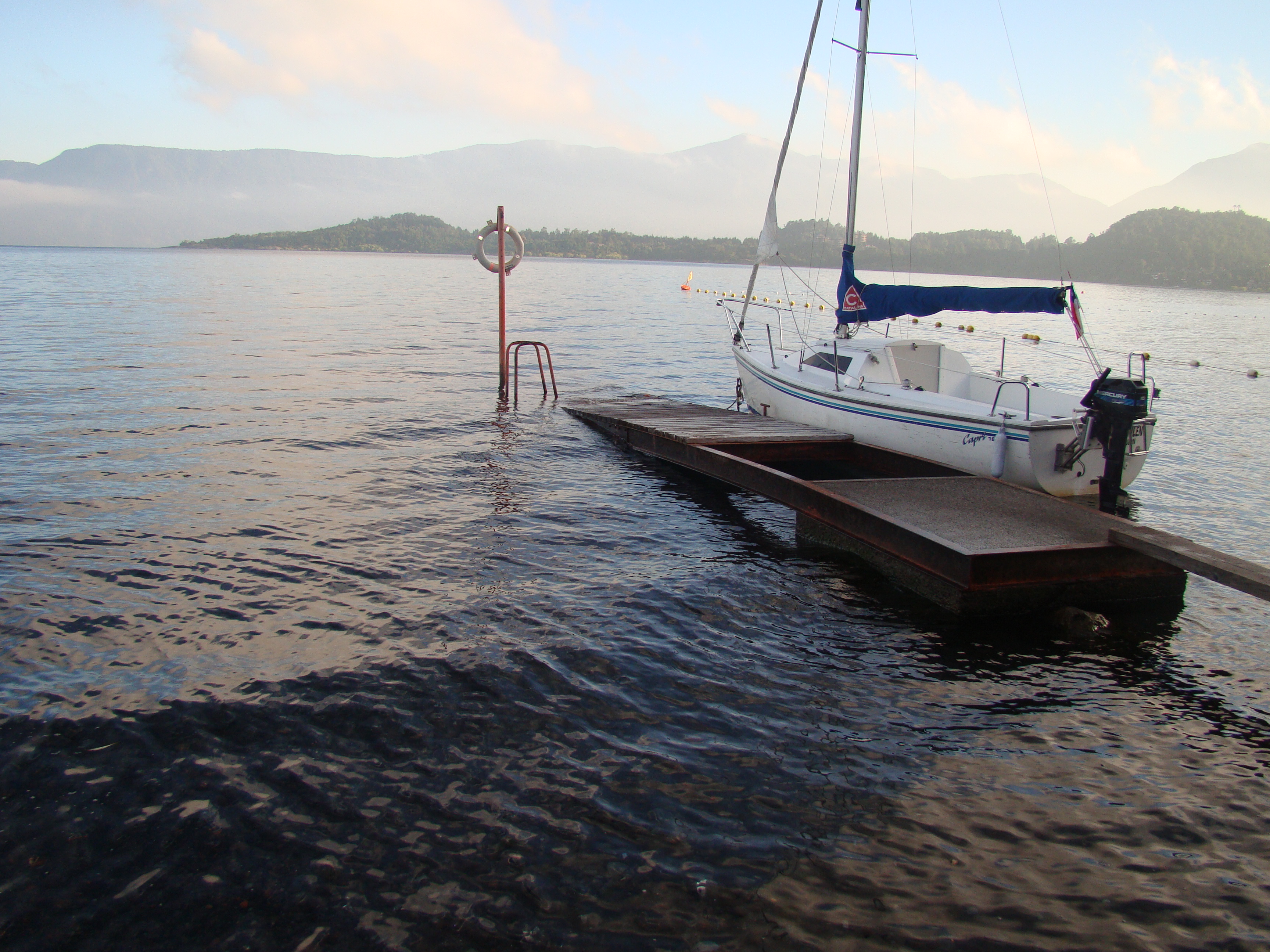
Figure 4 is a crack in the way down to the shore. A few 100 meters away what used to be a long flat beach, shows a large section sunk by about 3 meters (Figures 5, 6 and 7). Some small parts of the shore also sunk into the lake which can be seen by the small docks almost disappearing into the water (Figure 8).
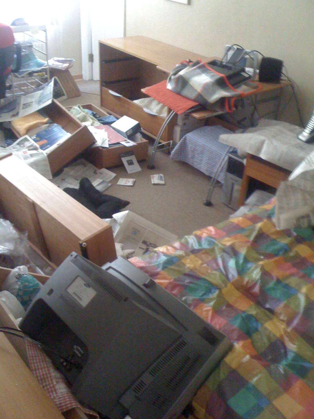
Last, Figure 9 shows the inside of my apartment in Santiago. It is on the 18th floor. Notice the distance of the drawers from the wall.
 |
 |
 |
| Figure 1. | Figure 2. | Figure 3. |
 |
 |
 |
| Figure 4. | Figure 5. | Figure 6. |
 |
 |
 |
| Figure 7. | Figure 8. | Figure 9. |